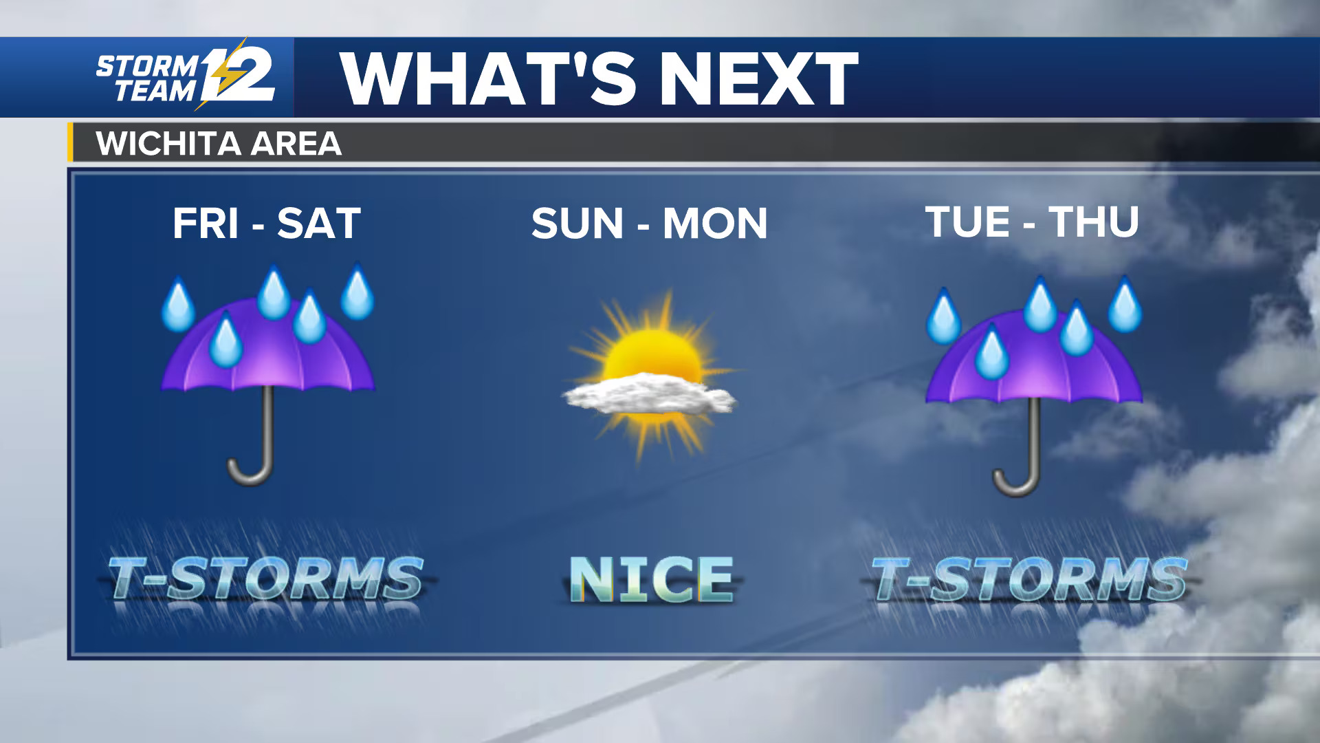
Louisville and southern Indiana remain under a tornado watch on Feb. 19 until 9 p.m., as severe storms are expected to move in during the afternoon, according to the National Weather Service in Louisville.
The watch covers Jefferson, Bullitt, Oldham, Shelby, and Spencer counties in Kentucky, along with Clark, Floyd, and Scott counties in Indiana. Forecasters warn residents to prepare for “a couple strong tornadoes,” scattered hail up to two inches in diameter, and wind gusts reaching 70 mph.
Meteorologists in Louisville say storms will move through the metro area intermittently throughout Feb. 19, with a cold front expected to sweep across the region by evening. The system could bring around half an inch of rainfall.
Officials advise residents under a tornado watch to have multiple ways to receive weather warnings. If a tornado warning is issued, seek shelter immediately in an interior room without windows, ideally on the lowest floor. If you are traveling and cannot reach shelter, get as low as possible and protect your head.


Leave a Reply