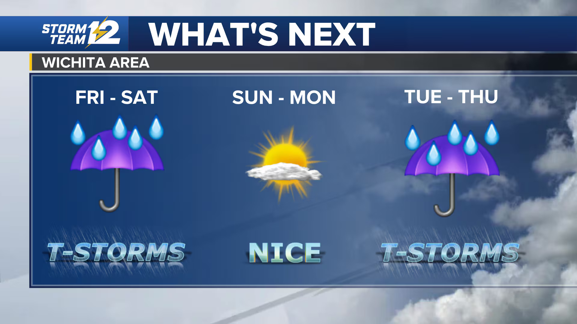
Scattered storms continue pushing east across the viewing area Sunday afternoon, and shower and storm coverage may continue to expand. Some storms could become strong to severe, with large hail and gusty winds posing the main threats.
Areas staying dry are seeing a mix of clouds and sunshine, with temperatures ranging from the low 70s in the northeast to the low 80s in the southwest. As storms develop, a few may intensify, bringing the potential for strong wind gusts and hail.
Widespread rain and thunderstorms are expected overnight and into early Monday morning, which could create problems for the morning commute.
Once the storms clear out Monday morning, much of the day should remain dry. A few storms could redevelop later in the afternoon, but it will not be a washout. High temperatures Monday will reach the mid-80s.
The weather turns pleasant from Tuesday through Thursday, with abundant sunshine and highs in the 80s each day. Rain chances are expected to return late in the week and continue into the weekend.


Leave a Reply