By mid-morning, the earlier line of storms had mostly weakened and moved out of central and eastern Kentucky. A few lingering showers may still occur, but conditions are trending quieter as clouds gradually thin.
With some breaks in the clouds, temperatures will climb into the upper 70s and low 80s. Humidity will remain noticeable, setting up the next round of weather later today.
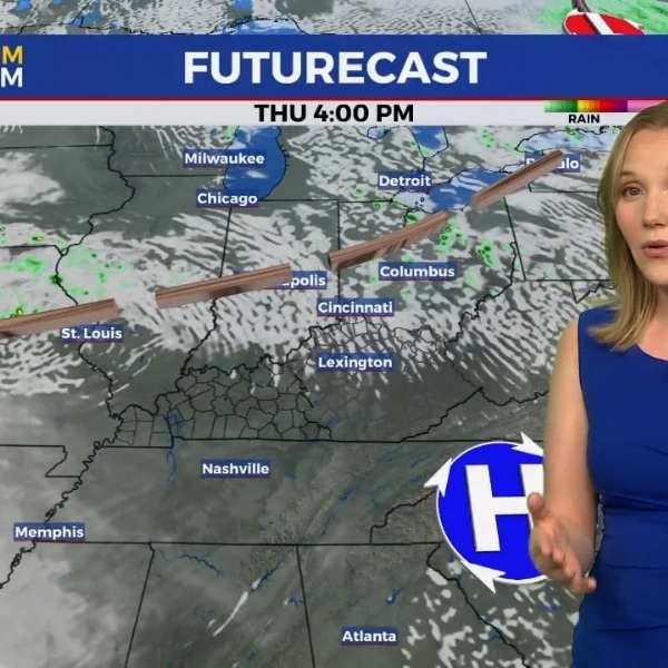
Strong storms return this evening
Another round of storms is expected to develop and move into the region during the evening and overnight hours.
This system has a better setup for strong to severe storms, especially across southern Kentucky, though central and eastern areas remain at risk. Damaging winds and large hail are the main threats, but an isolated tornado cannot be ruled out.
Residents should have multiple ways to receive weather alerts overnight.
Storms are expected to weaken gradually overnight, though some showers may linger into early Wednesday. Periods of drizzle could continue through Wednesday afternoon.
Turning cooler midweek
As the system moves out, a cold front will push through, bringing a noticeable change in conditions. Lingering rain will taper off as cooler, drier air moves in.
Afternoon highs will settle into the 60s and low 70s, offering a more comfortable feel compared to recent warmth.
The cooler pattern will continue through the end of the week and into the weekend, with highs generally in the 60s and nighttime lows dropping into the 40s and even upper 30s in some areas.
Mainly dry with minor rain chances
After the midweek system exits, conditions will remain mostly dry. A weak disturbance could bring a slight chance of light rain late Friday into Saturday, but widespread impacts are not expected.


Leave a Reply