Warm and Sunny Start Before the Weekend System
Friday brought pleasant conditions across the region, with plenty of sunshine and warm temperatures. Afternoon highs climbed into the low to mid-80s.
Conditions will remain calm for a while tonight. Temperatures will stay mild, only falling into the mid-50s to mid-60s overnight. Clouds will begin increasing late as the next weather system approaches from the northwest.
Showers and Storms Build In Saturday
Saturday is expected to turn much more active.
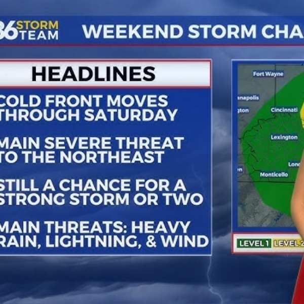
A few isolated showers may develop during the morning, but activity will increase later in the day. As a strong cold front moves into the region, showers will become more widespread, with scattered thunderstorms developing through the afternoon and evening.
While the overall severe threat remains low, a few storms could briefly turn strong. The main concerns include heavy rain, frequent lightning, and gusty winds. Some storms may produce stronger wind gusts, especially across eastern areas where slightly warmer conditions are expected.
Temperatures may rise into the 70s ahead of the front, but clouds and rain could limit warming in many places.
Rain Tapers Off and Cooler Air Moves In
By Saturday night, showers will gradually diminish from northwest to southeast. Cooler air will begin moving into the region behind the cold front.
Temperatures will drop quickly overnight, reaching the upper 30s to low 40s by early Sunday morning.
Cooler but Sunny for Sunday
Sunday will feel noticeably different from the recent warmth.
The day will start chilly, with morning temperatures in the upper 30s and low 40s. Sunshine will return, but afternoon highs will only reach the upper 50s to low 60s.
It will be a dry and refreshing end to the weekend, though significantly cooler than recent days.
Gradual Warm-Up Next Week
A steady warming trend begins early next week.
Monday and Tuesday look dry and pleasant, with temperatures climbing into the 60s and reaching the 70s by Tuesday. By mid to late week, highs will return to the 70s and may even reach the low 80s in some areas.
A few isolated rain chances may develop later in the week, but overall conditions will remain fairly calm with gradual warming.
36-Hour Forecast
Friday Night: Increasing clouds with mild temperatures. Lows in the mid-50s to mid-60s.
Saturday: Widespread showers with scattered thunderstorms. Highs in the 70s. Gusty winds and heavy downpours possible.
Saturday Night: Showers tapering off as cooler air moves in. Lows in the upper 30s to low 40s.


Leave a Reply