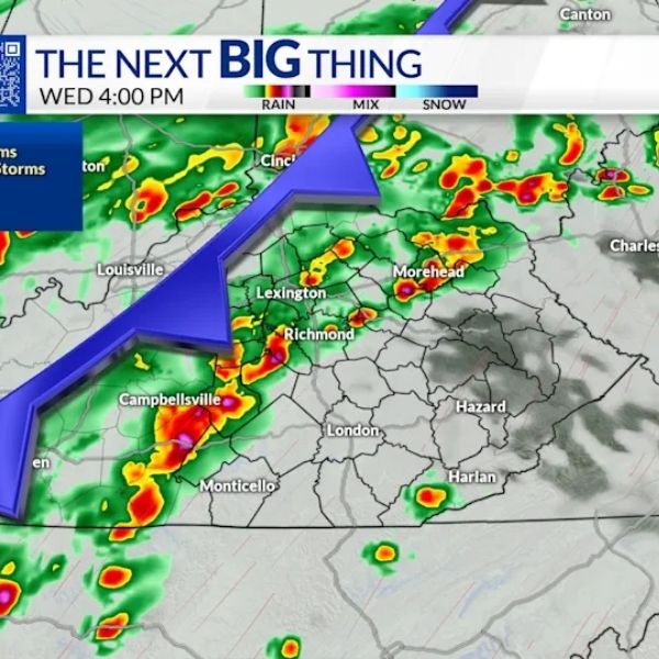
KENTUCKY (FOX 56) — Severe storms are expected across much of the state on Wednesday.
According to the Storm Prediction Center, the Bluegrass region is under a Level 2 risk for severe weather on March 11. This level indicates isolated to scattered severe storms could develop, bringing damaging winds, large hail, and possible tornadoes.
The FOX 56 Weather Authority said strong winds will arrive ahead of the storms on Wednesday, with gusts potentially exceeding 40 miles per hour.
Several parts of the state are currently under a tornado watch, while a wind advisory remains in effect for central and northern Kentucky until 6 p.m. The following counties are included in the tornado watch:
Bath
Boone
Bourbon
Bracken
Bullitt
Campbell
Carroll
Elliott
Fleming
Franklin
Gallatin
Grant
Harrison
Henry
Jefferson
Kenton
Lewis
Mason
Meade
Nicholas
Oldham
Owen
Pendleton
Robertson
Rowan
Scott
Shelby
Spencer
Trimble
What is a tornado watch?
A tornado watch means weather conditions are favorable for tornado development, but a tornado has not yet been confirmed. People should stay alert and be prepared in case one forms nearby.
Tornado watch or warning? Here’s the difference
A tornado warning means severe weather is already happening in the area and immediate shelter is necessary. For tornadoes, this warning is issued when radar detects rotation or when a trained spotter reports seeing a tornado.


Leave a Reply