A powerful winter storm system stretching from the Sierra Nevada to the Eastern Seaboard is poised to dump feet of snow across multiple states this weekend, prompting warnings from federal meteorologists and state transportation agencies.
The National Weather Service has issued Winter Storm Warnings for parts of California, while a separate nor’easter is forecast to deliver accumulating snow and strong winds to the Mid-Atlantic and Northeast.
Together, these systems span from the Pacific Coast to New England, creating a rare setup where snowfall totals could be measured in feet rather than inches across large portions of the country.
Sierra Nevada Braces for Up to 8 Feet
The National Weather Service office in Sacramento issued a Winter Storm Warning on Saturday, February 14, outlining a prolonged period of heavy snowfall from 10 p.m. Sunday through 10 p.m. Wednesday.
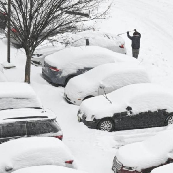
At higher elevations, forecasters expect 4 to 8 feet of snow, enough to bury roads and structures under heavy loads that could collapse roofs and trap vehicles for days. Lower elevations also face significant impacts.
Snow levels are projected to drop into the foothills, with about 1 foot of accumulation expected between 3,000 and 4,000 feet — sufficient to shut down smaller mountain communities and overwhelm local plow operations.
That lower snow line distinguishes this system from a typical mountain storm. Communities that rarely handle heavy snowfall could become isolated as drifts block narrow, winding roads and cut off supply routes and emergency access.
Winter Storm Warnings are reserved for severe conditions that are occurring or imminent and may be life-threatening. That designation signals that travel could become dangerous or impossible and that the storm poses a direct risk to anyone outdoors or driving in whiteout conditions.
Caltrans Warns of Sierra Pass Closures
California’s transportation agency is preparing for what it calls the coldest storm of the season. In a detailed briefing, Caltrans District 3 officials projected several feet of snow across Sierra passes, including 4 to 8 feet at higher elevations and around 1 foot between 3,000 and 4,000 feet.
Those projections closely match the National Weather Service forecast. Officials have warned that chain controls and full highway closures are likely, especially along the Interstate 80 corridor linking the Sacramento Valley to Reno and along U.S. 50 toward South Lake Tahoe.
The timing heightens the risk. Presidents’ Day weekend typically brings heavy traffic to Lake Tahoe and other mountain destinations, and the storm’s arrival during that busy travel period could leave thousands stranded if drivers attempt to outrun deteriorating conditions.
Caltrans urges motorists to monitor real-time road updates and avoid unnecessary mountain travel during peak storm hours. For those who must travel, officials recommend carrying emergency supplies such as food, water, blankets and a fully charged phone, since tow trucks and plows may struggle to reach stranded vehicles during periods of poor visibility and avalanche control operations.
Nor’easter Targets the East Coast
While the West deals with Sierra snowfall, a separate storm system is intensifying along the Eastern Seaboard. Forecasters expect accumulating snow, strong winds and widespread travel disruptions across the Mid-Atlantic and Northeast this weekend.
Localized snow bands could produce totals reaching several feet. This nor’easter expands an already broad winter weather event, stretching dangerous conditions from coast to coast and increasing the likelihood of flight cancellations and rail disruptions across major metropolitan corridors.
The Weather Prediction Center issued its Probabilistic Heavy Snow and Icing Discussion early Friday morning, valid from February 20 through February 23. That outlook provides probability ranges for exceeding snowfall thresholds of 6 and 8 inches across several regions, identifying where the most intense bands may form.
Emergency managers and local forecasters use this guidance to anticipate the highest-impact zones. Current probabilities indicate elevated risk across a wide portion of the eastern United States. Even if major cities such as Washington, Philadelphia and New York fall short of worst-case totals, moderate snowfall could still cause plowing delays, flight cancellations and hazardous commutes on untreated roads.
Why This Storm System Hits Differently
Most winter storm coverage centers on one region at a time. What makes this event unusual is the simultaneous impact of two separate systems — one battering the West and another targeting the East — during the same holiday weekend.
That overlap could strain national supply chains in ways isolated storms do not. Freight moving by truck over Sierra passes and along East Coast highways could face delays on both ends.
Perishable goods, fuel shipments and medical supplies may all encounter disruptions from multi-day road closures that ripple far beyond the snow zones.
The scale of the warnings also demands attention. Public focus often fixates on headline snow totals, but the greater threat frequently comes from secondary impacts. Heavy, wet snow can topple power lines and cause widespread outages. Avalanche danger rises in backcountry terrain.
Hypothermia becomes a serious risk for anyone stranded without shelter. The National Weather Service builds its warning system around these life-safety concerns, and current alerts reflect hazards that extend well beyond inconvenience.
When forecasters use the term “life-threatening,” they are describing a storm capable of causing fatalities among those who are unprepared or who underestimate the danger — whether that is a hiker caught in a sudden whiteout or a driver stranded overnight in subfreezing wind chills.
Forecast Limits and Public Responsibility
Winter weather communication often overlooks how well the public understands forecast uncertainty and shared responsibility. Agencies such as the National Oceanic and Atmospheric Administration rely on ensemble models and probabilistic tools that present a range of outcomes rather than a single number.
Yet many people focus only on the highest or lowest snowfall estimate they hear. When forecasters state there is, for example, a 30 to 50 percent chance of more than 8 inches of snow, that should prompt preparation for the higher-impact outcome, even if it ultimately does not occur.
Federal meteorologists consistently emphasize that forecasts carry uncertainty and must be interpreted carefully. The Weather Service’s disclaimer language notes that products are provided “as is,” placing responsibility on individuals and organizations for decisions based on that information. In practice, that means residents and travelers should act early on watches and warnings by adjusting travel plans, stocking essentials and checking on vulnerable neighbors, rather than waiting for perfect certainty before taking action.
Behind the Warnings: Data, Credits, and Preparedness
Major winter storms rely on an extensive network operating behind the scenes. Observation systems, forecast offices and communication teams convert radar data, satellite imagery, surface reports and model output into actionable alerts that appear on phones and highway message boards.
The Weather Service documents detailed credits and attribution for these products, reflecting coordination among local offices, national centers and partner agencies during high-impact events.
For the public, the message is clear. Heed Winter Storm Warnings and travel advisories, and treat words like “dangerous” and “life-threatening” as literal descriptions rather than exaggerations.
Avoid mountain passes and coastal interstates when officials advise staying home, and prepare homes and vehicles for several days of potential disruption. As this coast-to-coast storm system shows, a single holiday weekend can bring compounding hazards to millions, and the difference between a near miss and a tragedy often depends on how seriously those early warnings are taken.
This article has been carefully fact-checked by our editorial team to ensure accuracy and eliminate any misleading information. We are committed to maintaining the highest standards of integrity in our content.


Leave a Reply