The Ohio Valley is expecting a changing weather pattern this week, bringing rain, snow, and rising river levels across parts of the region and the Great Lakes drainage basin.
A weak weather system on Wednesday will bring light rain south of the Ohio River, impacting areas of Tennessee, Kentucky, southern West Virginia, and the New River basin. While rainfall amounts are expected to be modest, wet ground could increase runoff in some locations.
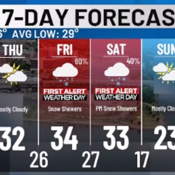
A stronger cold front will move across the Ohio Valley on Thursday, producing widespread rain before temperatures drop. Forecasters say precipitation is likely to transition from rain to snow Thursday night into Friday, especially across Indiana, Ohio, and portions of the central Ohio Valley.
Hydrologists caution that some rivers could rise to action-stage levels, particularly in southern Indiana. While widespread flooding is not expected, certain rivers and streams may reach levels that require monitoring. A 10-day river outlook indicates mostly normal flows, with only isolated areas showing elevated risk. Officials note that action-stage rises do not constitute flooding but signal potential impacts if additional precipitation occurs.
Residents near rivers, creeks, and low-lying areas are urged to stay updated on forecasts, especially as colder temperatures and snow move in. Travel disruptions are possible Thursday night into Friday during colder overnight conditions.


Leave a Reply