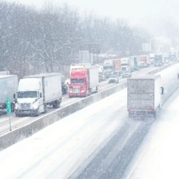
A fast-moving swath of accumulating snow and slick travel will target much of the Interstate 64, 81 and 85 corridors in Virginia through Monday evening.
A quick-moving storm is delivering snow and slippery roads to begin the workweek across parts of Kentucky, Virginia, West Virginia and North Carolina. Forecasters expect the wintry weather to last into Monday evening. Once the storm passes, plunging temperatures will freeze wet or slushy spots, creating more travel issues from Monday night into early Tuesday.
Even though the storm started as rain east of the Appalachians, colder air pushing in from the north and west will turn the moisture to snow as the system heads offshore. The cold, dry air will keep accumulating snow away from Washington, D.C., and should leave Philadelphia and New York City dry.
Snow will fall on areas that already dealt with wintry weather late last week.
<h3>Heaviest Snowfall Expected in Parts of Virginia and North Carolina</h3>
Forecasters expect the heaviest snow from southwestern Virginia into northwestern North Carolina, northeastern Tennessee and southeastern West Virginia. This zone could see 3 to 6 inches of snow on the back end of the storm, with an AccuWeather Local StormMax™ of 10 inches possible. Blacksburg, Virginia, sits close to the area expected to receive the most snow.
Farther east, forecasters expect 1 to 3 inches in southeastern Virginia and the northern tier of North Carolina, including Richmond, Norfolk and Danville. Winston-Salem and Raleigh could see a coating to an inch of wet snow.
Motorists should prepare for rapidly changing road conditions. Wet roads early in the storm will quickly turn wintry as colder air moves in and snow begins falling at a moderate to heavy rate.
Rain to the South, But Ice Still a Risk
Along Interstates 77, 81, 85 and 95, rain will fall in cities like Charlotte, Fayetteville and Asheville, North Carolina, as well as Knoxville and Chattanooga, Tennessee.
Even in areas that only see rain, temperatures will drop below freezing Monday night before surfaces can dry. Some roads that appear just wet may actually hide a thin sheet of ice.
Another Storm on the Way
The next system, an Alberta Clipper, will mainly affect the Midwest and interior Northeast. Still, forecasters expect snow over the southern Appalachians as colder air arrives behind the storm from late Wednesday into early Thursday. Drivers on Interstates 64, 68, 75, 77, 79 and 81 should expect patches of wintry conditions along large stretches of their routes.
This article has been carefully fact-checked by our editorial team to ensure accuracy and eliminate any misleading information. We are committed to maintaining the highest standards of integrity in our content.


Leave a Reply