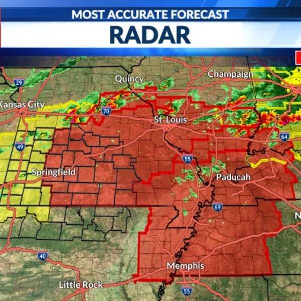
The National Weather Service has issued a Particularly Dangerous Situation (PDS) Tornado Watch covering the Missouri Bootheel, northeast Arkansas, southern Illinois, western Kentucky, and western Tennessee.
Forecasters warn that several tornadoes are likely, with some potentially becoming intense. These storms may also produce very large hail up to 2.5 inches in diameter—about the size of a tennis ball.
Meteorologists expect intense supercells to form ahead of a frontal boundary, bringing multiple rounds of severe weather through the evening. Strong and potentially deadly tornadoes, including EF3 or greater, are possible.
In the Ozarks, storms are expected to begin developing late this afternoon before rapidly intensifying as they track east. The highest risk for large, damaging tornadoes will be in areas along and especially east of Highway 63.
If a tornado warning is issued, residents should take shelter immediately in a safe location. Move to the lowest level of a sturdy building, staying away from windows and exterior walls.
The tornado watch remains in effect until 11:00 p.m. Monday, April 27.


Leave a Reply