LONG TERM: Showers arrive Friday night, possibly lingering into Saturday morning | Monday strong storms
LATEST FORECAST
LOUISVILLE, Ky. (WAVE) — A nearby cold front to the north will trigger isolated showers and storms after midnight tonight, mainly affecting areas like Seymour, Madison, North Vernon and Scottsburg, Indiana. Locations closer to Louisville and much of Kentucky are expected to stay dry, with overnight lows in the warmer 50s.
Any storms early Wednesday north of Louisville will fade by midday, leading to a partly sunny afternoon with highs in the 70s and lower 80s. Winds will be noticeable, with southwesterly gusts reaching up to 30 mph. Conditions improve Wednesday night, with mostly clear skies and lighter winds, bringing lows back into the 50s by Thursday morning.
Thursday brings a return to very warm weather, with highs climbing into the 80s under sunny skies and steady southwesterly winds. While temperatures won’t break records, they will come close in some spots.
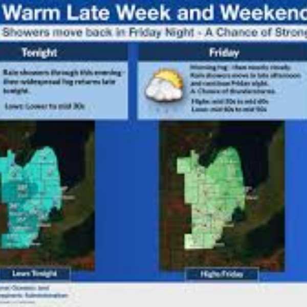
Rain and thunderstorms are expected to move in Friday evening ahead of another cold front. Some showers could linger into Saturday morning, potentially causing disruptions for KDF marathon runners and affecting both the Friday night balloon glow and Saturday morning balloon race.
Sunday looks quieter, with warm highs in the 70s. Attention then turns to Monday, when another system is expected to bring widespread storms, some of which could become strong to severe. Areas west of the region may face a higher risk, though it is still too early to determine exact details.


Leave a Reply