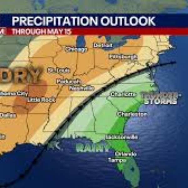
SOUTHEAST UNITED STATES — The latest midday GFS model run points to a much wetter pattern across the Southeast over the next 16 days, with some areas potentially receiving up to 10 inches of rainfall. Forecasters say this shift could help ease the ongoing drought in parts of the region as rain chances increase starting this weekend and extend into early May.
Meteorologists caution that long-range projections like this often adjust as the timeline shortens. Still, the overall signal of a meaningful pattern change appears reliable and is being closely monitored.
What the GFS model indicates
The latest run highlights the heaviest rainfall across parts of the mid-South and central Southeast. Some areas fall within a core zone where totals of 9.57, 10.32 and 8.48 inches are projected over the 16-day period. Nearby regions could see widespread totals between 3 and 6 inches, with values such as 5.51, 5.05 and 4.04 inches indicated.
Farther south, especially along the Gulf Coast, expected rainfall drops significantly, with many locations forecast to receive less than 1 inch during the same timeframe. This sharp contrast shows the heaviest precipitation focusing inland rather than along the coast.
Drought relief possible, but uncertainty remains
Forecasters stress that uncertainty is still high at this range. Long-term models often show exaggerated rainfall totals that typically decrease as the forecast becomes more precise. However, confidence is higher in the broader trend — a transition away from the dry, quiet conditions that dominated much of April.
With increased storm chances and a more active weather pattern, multiple rounds of rainfall over the next two weeks could bring meaningful drought improvement, even if totals fall below current projections.
Storm chances increase this weekend
In the short term, meteorologists are watching for a more active storm setup beginning this weekend and continuing into early May. As the atmosphere becomes more unstable, the region could see not only beneficial rain but also periods of strong storms.
Residents are encouraged to stay updated on forecasts as details about timing and storm intensity become clearer in the coming days.


Leave a Reply