NASHVILLE, Tenn. (WKRN) — Two rounds of rain and storms are expected Thursday across the region, with the second round bringing a slight risk of isolated severe weather. However, no cold front will follow immediately, allowing heat and humidity to linger into the first half of the weekend.
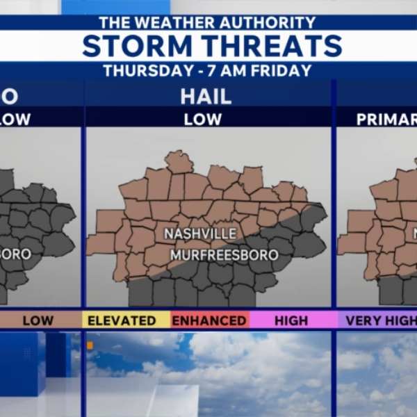
The Storm Prediction Center has placed all of Southern Kentucky and much of Middle Tennessee under a Marginal Risk (level 1 of 5) for Thursday afternoon and evening storms.
The overall threat remains low, with the primary concerns being gusty winds, small hail, and heavy rain. The tornado risk is considered near zero.
The first round of rain and scattered storms is expected from morning into early afternoon, mainly west of I-65. These storms are not expected to reach severe levels but may still bring brief downpours.
By Thursday afternoon, breaks in sunshine will help destabilize the atmosphere, fueling stronger storm development to the west. These storms are expected to move east, reaching areas near the Tennessee River around 4 p.m., crossing I-65 by about 7 p.m., and exiting the region after 9 p.m.
Conditions turn mostly dry and hotter again on Friday.
The weekend will bring a shift in conditions. Saturday is expected to be warm with increasing chances for storms as a cold front approaches, while Sunday will be cooler and breezy, with highs dropping into the 60s after rain clears out in the morning.


Leave a Reply