LEXINGTON, Ky. (WKYT) — One of the warmest April days on record is unfolding across Kentucky and nearby states, with record highs likely to fall. This summer-like pattern will continue into the start of the weekend before a major shift arrives.
Temperatures today are ranging from the mid-80s to near 90 degrees across much of the state, driven by strong southwest winds reaching around 30 mph or higher.
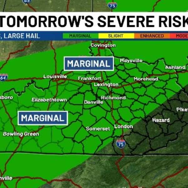
Conditions will cool slightly on Thursday as scattered showers and thunderstorms move in. The Storm Prediction Center has placed parts of the state under a low-end severe weather risk.
The primary threats include pockets of damaging winds and large hail.
Warm and breezy weather returns Friday, with highs climbing back into the 80s.
A strong cold front is expected late Saturday, bringing a line of showers and thunderstorms. Behind it, much colder air will surge in, sending temperatures from well above normal to well below normal.
Highs on Sunday may struggle to get out of the 50s, with the potential for frost and a light freeze Sunday night into Monday morning.
Temperatures are expected to rebound quickly, with highs returning to the 70s by Tuesday and continuing through the rest of the week.


Leave a Reply