Happy Friday! Our current winter storm is slowly moving from northwest to southeast this morning, but attention now turns to the next winter storm threat for Saturday and Saturday night, followed by a blast of brutally cold air to close out the weekend.
Several inches of snow have already been reported, with some areas seeing around 4 inches. As the system continues, additional reports of 5 inches or more are possible.
This system tracked slightly farther south than expected, due to a stronger high-pressure system to the north. That pushed the heavier snow south by roughly 40–50 miles, resulting in more snow in southern areas and lighter amounts in the north and northeast.
Winter alerts:
-
Winter Storm Warnings and Winter Weather Advisories are already in effect.
-
A Winter Storm Watch has been issued for northern regions on Saturday.
Many roads are snow-covered this morning, and conditions can be monitored on Kentucky Weather Cams. The next system will have the greatest impact in northern and northeastern Kentucky, and updates will continue throughout the day.
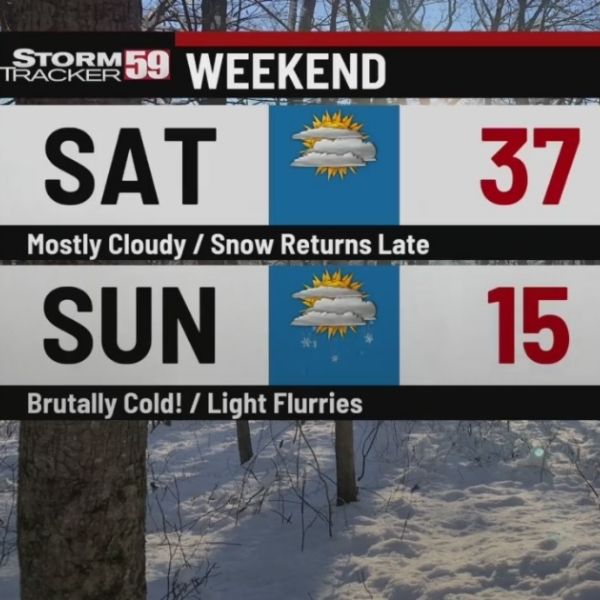
Cold Weather Advisories are expected Saturday night through Sunday night as dangerously low wind chills move in. Wind chill values could reach extreme lows, while actual air temperatures may dip to -5 to 5 degrees above zero in areas with deep snowpacks.
Highs on Sunday are expected to range from high single digits to low teens in snow-covered areas, with mid-to-upper teens in snow-free regions. Brutal wind chills will persist into Monday, with lows again possibly falling to -5 to 5 degrees above zero.
By Tuesday, milder southwest winds should bring a temporary reprieve, though another cold front may arrive by Thursday, pushing temperatures below normal once again.
This article has been carefully fact-checked by our editorial team to ensure accuracy and eliminate any misleading information. We are committed to maintaining the highest standards of integrity in our content.


Leave a Reply