St. Louis – temperatures will climb Wednesday, and that warmup brings the chance of strong and severe storms across the region.
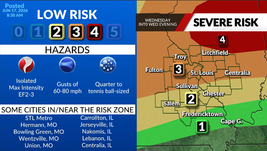
A Level 3 (out of 5) risk covers a large stretch of the northern viewing area Wednesday afternoon and evening, while the southern portion sits under a Level 2 (out of 5) risk. A tiny sliver of the far northeastern viewing area faces a Level 4 (out of 5) risk.
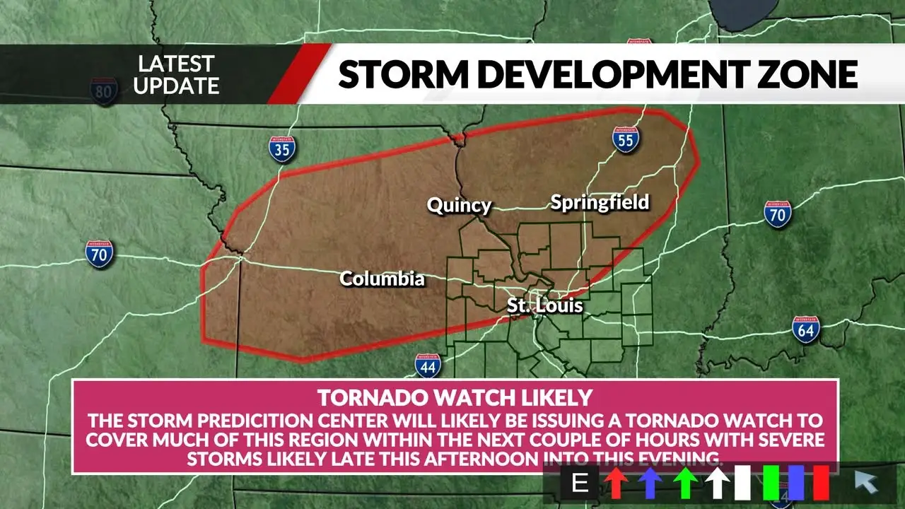
A tornado watch covers most of the FOX 2 viewing area until 10 p.m. Wednesday, and Phelps County is under a Severe Thunderstorm Watch until the same time.
Strong wind gusts, large hail, and possibly strong tornadoes are among the threats.
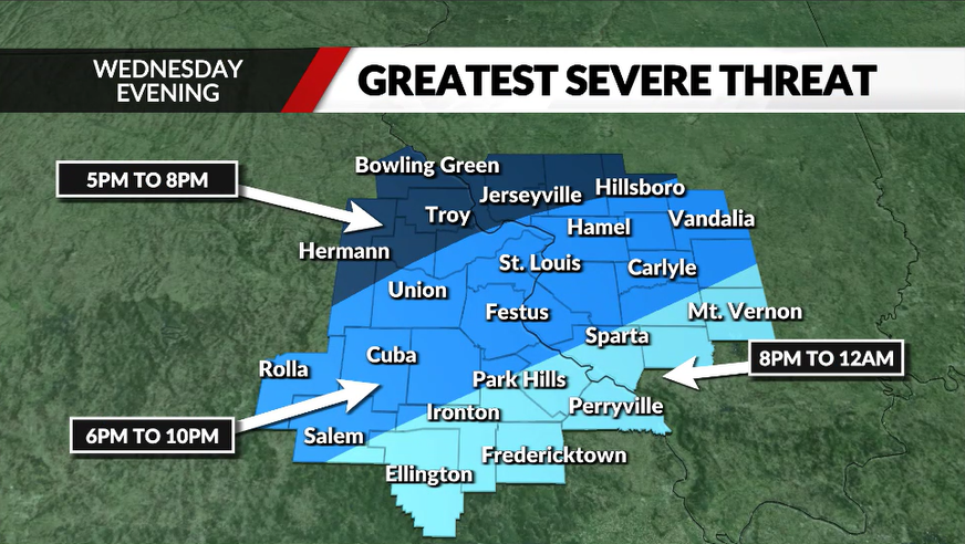
Meteorologist Chris Higgins says the main event will hit between 3 p.m. and 5 p.m. for northeast Missouri into central Illinois. As the cold front moves in, the storms will steadily push southeast, and they could turn quite severe.
The storms will reach southwestern Missouri up to northeastern Illinois, including Metro St. Louis, between 6 p.m. and 10 p.m. as they continue southeast. The southeastern part of the viewing area, spanning both Missouri and Illinois, should expect the system to move in between 8 p.m. and midnight.
The biggest concern is winds reaching 60-80 mph at times. An elevated tornado risk exists north of Interstate 70 across northeast Missouri and central Illinois, and any tornado that forms could reach the intensity of an EF-2 or EF-3. Hail could range from quarter-size to tennis-ball size.
Several Illinois counties, including Greene, Montgomery, Jersey, and Macoupin, are under a tornado watch until 3 p.m. As of 1:15 p.m., Higgins added that the Storm Prediction Center is likely to issue tornado watches within the next few hours.


Leave a Reply