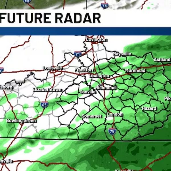
LEXINGTON, Ky. (WKYT) — Keep the umbrella handy Sunday as widespread rain moves across Kentucky through the afternoon and into the evening.
A strong area of low pressure tracking across the Deep South will keep showers in place for much of the day. Western Kentucky may begin drying out by late afternoon, but eastern parts of the state could see rain linger into the evening hours. Afternoon highs will struggle, topping out in the upper 40s.
President’s Day Outlook
Monday morning may start with areas of dense fog before skies gradually turn partly sunny in the afternoon. Morning lows will dip into the upper 30s, with afternoon highs climbing into the mid to upper 50s.
Midweek Spring Surge
A noticeable warm-up arrives midweek as a southerly breeze pushes temperatures well above average. Highs will reach into the 60s for much of the week, and some locations could approach 70 degrees by Thursday. A few scattered, hit-or-miss showers are possible Wednesday and Thursday, but much of the time will be dry and mild.
Late-Week Cold Front
By Friday, a potent cold front is expected to move into the Ohio Valley, bringing a renewed chance for showers and possibly gusty thunderstorms Friday into Saturday. Behind the front, temperatures will cool back down to more typical February levels, with highs returning to the 40s.
Kentuckians should enjoy the midweek taste of spring — but keep an eye on changing conditions as the week wraps up.


Leave a Reply