NASHVILLE, Tenn. (WKRN) — The next storm system moving into Middle Tennessee and southern Kentucky could bring a mix of snow, sleet, and rain.
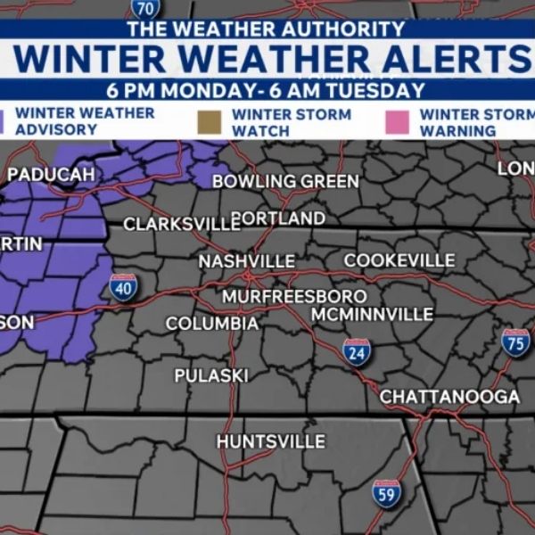
A Winter Weather Advisory is in effect from 6 p.m. Monday through 6 a.m. Tuesday for Carroll, Henry, Decatur, and Benton counties. Slick roads are possible due to the wintry mix, so drivers should be prepared for potentially hazardous conditions during the Tuesday morning commute.
Some areas could see a light coating of snow—up to half an inch—mainly on grassy and elevated surfaces. Areas south of Clarksville are expected to get a rain, sleet, and snow mix with little to no accumulation. The rest of the region will see rain.
Prepare for rain as early as 2 p.m. Monday west of I-65, with coverage becoming more widespread through the afternoon and evening. From midnight into early Tuesday, a wintry mix is likely, especially north of I-40. It may continue until about 8 a.m. Tuesday before clearing to the east.
This article has been carefully fact-checked by our editorial team to ensure accuracy and eliminate any misleading information. We are committed to maintaining the highest standards of integrity in our content.


Leave a Reply