NASHVILLE, Tenn. (WZTV) — FOX 17 News issued a Code Red Weather alert for Tuesday, warning of a low-end severe threat across portions of Middle Tennessee and Southern Kentucky, with a slight risk upgrade for counties in the northwest.
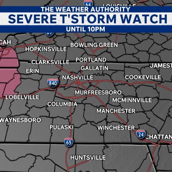
A severe thunderstorm watch is also in effect for parts of the western counties until 10 p.m.
Meteorologists are monitoring several storms to the west that are currently severe and tornado-warned, but they do not expect those storms to hold their strength as they move into Middle Tennessee.
The main threats include damaging winds and hail, with a small chance of a spin-up tornado if conditions line up. Even so, tornado potential remains very low through the early afternoon.
Between 5 p.m. and midnight, the chance for a brief tornado increases slightly, along with the risk of damaging wind and hail, especially for areas along and north of I-40. Areas south of I-40 face a lower chance of storms, and many southern communities may stay dry all day.
Wednesday will bring a short break from the storm activity, but storms are expected to return Thursday and Friday, with a low risk of severe weather currently forecast for both days.
This article has been carefully fact-checked by our editorial team to ensure accuracy and eliminate any misleading information. We are committed to maintaining the highest standards of integrity in our content.


Leave a Reply