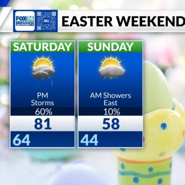
Warm and sunny weather is expected on Easter Saturday, followed by scattered strong storms in the afternoon. Cooler air will move in afterward, with frost possible in some areas early next week.
Video note: Despite this article’s time stamp, the above video is the latest forecast from The Weather Authority.
LEXINGTON, Ky. (FOX 56) — Easter weekend will bring a mix of weather conditions, starting with a warm, breezy, and sunny Saturday morning before scattered strong storms develop later in the day.
Read more of the latest Kentucky news
A cold front will move through, dropping temperatures by about 25 degrees by Sunday afternoon. Despite the cooldown, skies will remain mostly sunny.
The greatest risk for scattered severe storms is expected across northern Kentucky Saturday afternoon and evening.
Wind will be the primary threat as the cold front triggers storms in the early afternoon, followed by a more organized line of storms into the late evening and overnight. Residents are advised to stay alert.
Rain showers may linger across eastern Kentucky early Sunday morning, but skies will quickly clear as cooler air settles in.
The cold front arriving on Easter Sunday will bring several days of seasonably cool temperatures.
Frost may develop in some areas early next week before warmer conditions return by the following weekend.


Leave a Reply