Louisville, KY — A line of showers and thunderstorms could move through central Kentucky and southern Indiana on Saturday, bringing gusty winds and small hail.
According to the National Weather Service in Louisville, storms are expected to develop ahead of a cold front moving west to east across the region during the day Saturday.
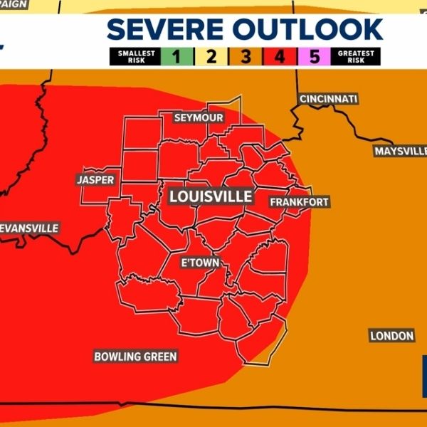
Forecasters say some storms may become strong, with gusty winds and small hail identified as the main severe weather threats.
The timing of the strongest storms is expected to vary across the region:
8 a.m. to 12 p.m. EST: Areas west of Interstate 65
12 p.m. to 1 p.m. EST: I-65 corridor
1 p.m. to 4 p.m. EST: Areas east of Interstate 65
The National Weather Service currently places much of central Kentucky and southern Indiana under a low-confidence severe weather risk, though isolated stronger storms remain possible.
Officials advise residents to stay weather aware and use multiple ways to receive warnings, especially since the storms are expected during daytime hours.
Strong wind gusts could cause brief travel disruptions, downed tree limbs, or isolated power outages in stronger storms on Saturday.


Leave a Reply