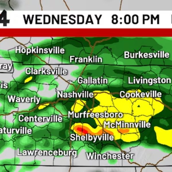
NASHVILLE, Tenn. (WSMV) — Keep umbrellas handy this evening through tomorrow morning.
NEXT 24 HOURS
Clouds, warmer temperatures and breezy conditions will settle across Middle Tennessee and Southern Kentucky today, with highs reaching the upper 50s to near 60 degrees.
A few isolated showers may pop up early this evening, but steadier rain will develop tonight and continue overnight. Scattered showers will linger into tomorrow morning before conditions dry out during the afternoon. Highs will again climb close to 60 degrees.
TODAY’S FORECAST
EVENING – Rain develops. Temperatures fall into the 50s.
OVERNIGHT – Rain with a few non-severe thunderstorms. Low near 50.
TOMORROW’S FORECAST
MORNING – Cloudy with scattered showers. Temperatures near 50.
AFTERNOON – An early shower, then gradual clearing. High near 60.
EVENING – Partly cloudy skies. Temperatures drop into the 40s.
FRIDAY FORECAST
MORNING – Partly cloudy, low in the 40s.
AFTERNOON – Plenty of sunshine and mild conditions. High in the mid-60s.
EVENING – Mostly clear and cool, with temperatures falling into the 40s.
THIS WEEKEND
Saturday will bring sunny and warm weather, with highs in the upper 60s to near 70.
Sunday will feature more clouds but still plenty of sunshine, with highs in the low to mid-60s.
NEXT WEEK
Highs will stay near 60 from Monday through Wednesday, with showers possible each day.
This article has been carefully fact-checked by our editorial team to ensure accuracy and eliminate any misleading information. We are committed to maintaining the highest standards of integrity in our content.


Leave a Reply