LEXINGTON, Ky. (FOX 56) — A chilly weekend wrapped up with scattered snow showers and brief peeks of sunshine across central Kentucky.
The new week will begin on a cold note before temperatures gradually moderate, bringing the next opportunity for rain showers by midweek.
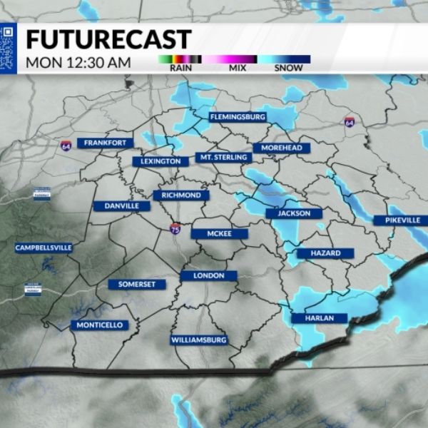
Winter Weather Advisory in Effect
A Winter Weather Advisory remains in place for Floyd, Knott, Leslie and Perry counties through 7 p.m. Monday, according to the National Weather Service. Wind gusts between 20 and 30 mph could reduce visibility at times as snow continues to fall.
Tonight and Monday Forecast
Overnight lows will drop into the low to mid-20s, with wind chills falling into the teens. Scattered snow flurries are possible throughout the night and into Monday morning.
Monday’s high temperatures will stay in the 30s, similar to Sunday. Early morning wind chills could dip into the upper single digits. Flurries may linger through the morning and early afternoon before skies begin to clear by evening.
Midweek Warm-Up Brings Rain
Warmer air will settle in for the rest of the week, but it will also bring rain chances. Showers are expected to move in late Wednesday night and continue through Thursday before clearing out late Thursday night.
It will be a cold start to the week, followed by a modest warm-up — along with the return of rain showers.


Leave a Reply