A meteorologist known for tracking severe weather is warning that multiple regions across the country could soon face a “train” of winter storms.
Max Schuster, the meteorologist behind the Max Velocity Severe Weather Center channel, told viewers this week that the West Coast, Plains, Midwest, and even parts of the East may soon be hit by a series of winter storms.
Schuster cautioned people not to “get used to” the relatively calm February many areas have experienced, saying weather turmoil could develop soon. His warning comes as the death toll from extreme cold in New York continues to climb, with city officials acknowledging that Code Blue “came too late.”
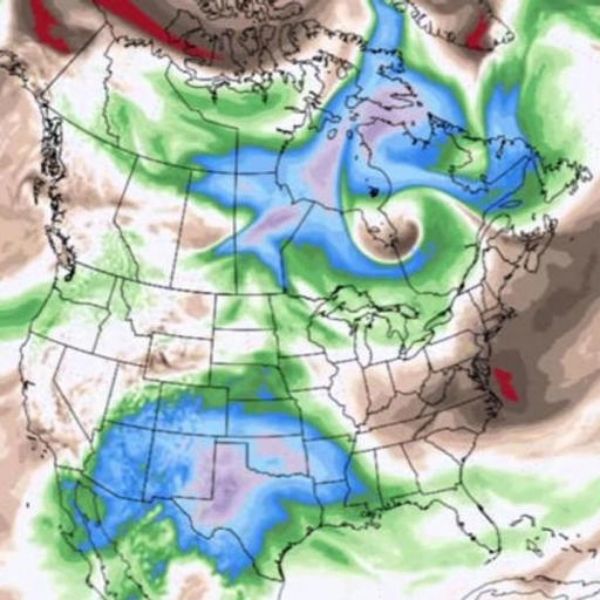
He explained that moisture from the Pacific will fuel an active jet stream, which could evolve into storms that strengthen rather than weaken as the pattern continues.
According to Schuster, the first system could form in the West, where moisture is expected to surge into the mountains over the coming days. That setup could produce heavy snowfall totals of up to 8 feet in higher elevations.
He described the potential setup as a “snow bomb” exploding across mountain regions in the West.
Instead of staying confined there, the system’s moisture could push eastward, intensifying conditions in the Southeast, including areas such as Dallas, Austin, Shreveport, Louisiana, and Abilene, Texas.
Schuster said cold air moving south from the north, combined with warmth from the Gulf, could spark thunderstorms in warmer zones while bringing snow and ice to colder parts of the Southeast.
He noted that it remains uncertain whether the storms will become catastrophic, as that depends on how weather patterns in the Pacific align with systems in the Southeast.
Still, he urged people to monitor conditions through the weekend. Severe weather could begin developing as early as Friday night in West Texas, then move into Arkansas and the mid-South by Saturday afternoon.
He added that Sunday could also bring risks to states such as Tennessee and Georgia. Although Florida is not currently a primary concern, Schuster said rough conditions there cannot be ruled out.
Interestingly, he pointed out that these potential storms coincide with a warming trend emerging in mid-February across several regions, including the Great Plains, where temperatures could climb to 40 to 45 degrees Fahrenheit next week.
Meteorologists from other organizations have also highlighted a stretch of warmer weather during the third week of February.
“The most intense cold of the winter is largely behind the Eastern and Central states, but that doesn’t mean winter is over,” said Paul Pastelok, lead long-range meteorologist at AccuWeather. “However, new risks will arise due to the warmup as colder, stormier conditions shift to the West.”
In the Northeast, temperatures could rise into the 40s and upper 50s, while the Southeast may see several days in the 60s and even some reaching the 70s to near 80 degrees.
AccuWeather also warned that while February’s milder weather will likely melt lingering snow and ice, it could also trigger river flooding and ice jams.


Leave a Reply