Snow and dangerously cold temperatures are expected across Middle Tennessee and Southern Kentucky this weekend as FOX 17 News issues a Code Red alert for an incoming cold plunge.
A cold weather advisory will be in effect from midnight Friday through noon Sunday. Overnight temperatures are expected to fall into the low teens and single digits on Friday, Saturday, and Sunday, while daytime highs will struggle to climb out of the 20s.
Wind chill values could drop as low as 5 degrees below zero during the early morning hours on Saturday, Sunday, and Monday.
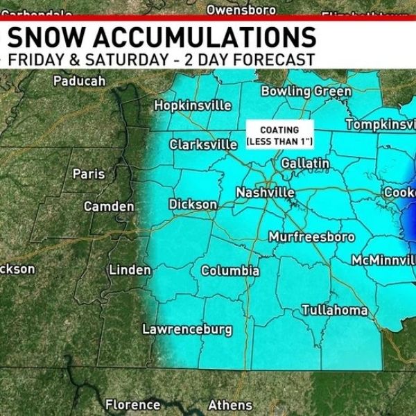
A developing low-pressure system is forecast to bring snow showers to Middle Tennessee beginning Friday afternoon. Although the system is not expected to produce a major snowfall, it could still cause travel issues Friday night and Saturday.
The Cumberland Plateau is expected to see the highest snow totals, with around 1 inch of accumulation and isolated areas possibly receiving up to 2 inches. Other parts of Middle Tennessee may see a light dusting of snow, generally less than 1 inch.
Snow is expected to fall over a two-day period, starting Friday morning and continuing through Saturday night. This could lead to icy road conditions, particularly Friday night into Saturday morning and again Saturday night.
Areas already covered in ice may receive a light layer of snow, creating hidden slick spots on sidewalks, parking lots, and roadways.
Warmer conditions are expected to return next week, with highs rising back into the 40s from Monday through Wednesday.


Leave a Reply