Plenty of snow remains on the ground across Kentuckiana, along with an abundance of cold air, and more of both are expected over the next few days.
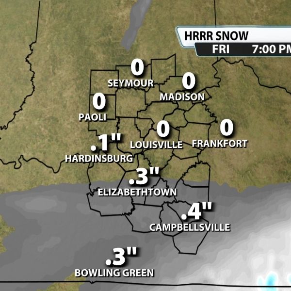
An area of low pressure will move in from the west tonight and pass south of the region on Friday, bringing a chance of snow to many counties in Kentucky.
A quick 0.1 to 0.5 inches of snow is possible, mainly for areas south of I-64. With ground temperatures cold enough to support accumulation, slick spots could develop on roadways throughout Friday.
Another round of snow is possible Saturday as energy moves into the region from the north. Increased lift and moisture may trigger snow showers across much of Kentuckiana. While coverage remains uncertain, snowfall totals are expected to be even lighter than Friday, with a brief dusting being the most likely outcome.
The Saturday snow chance will also usher in another surge of Arctic air. Temperatures are expected to drop into the single digits this weekend, with wind chills occasionally falling below zero.
The next opportunity for most of the area to see above-freezing temperatures is expected around February 3 or 4, though overnight lows will likely remain below freezing.


Leave a Reply