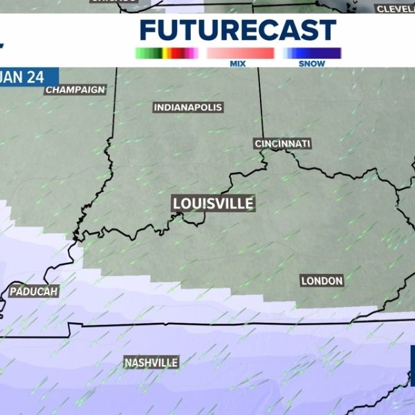
LOUISVILLE, Ky. — The chances for a snow-producing winter storm are increasing for the Ohio Valley this weekend. Moisture moving north from the south is expected to meet freezing temperatures by Saturday afternoon.
The storm could last through much of the weekend, followed by intensely cold temperatures.
Arctic air arrives
Another surge of arctic air is expected to move into the Ohio Valley Friday night into Saturday. This frigid air will combine with southerly moisture, creating favorable conditions for snow showers to develop by Saturday afternoon.
Saturday snow
Snow showers are likely later Saturday afternoon, particularly in southern and southwestern areas, including northern Tennessee. By Saturday evening, snow will begin to spread into Kentuckiana. Late Saturday night, snow showers are expected across the Ohio Valley, with the heaviest snow remaining farther south, while Kentuckiana can expect steady, moderate snowfall overnight.
Sunday morning snow
Snow showers are expected to continue Sunday morning, delivering steady snow across the Ohio Valley. Air temperatures will remain very cold, with values in the single digits possible. Accumulations could reach close to an inch by Sunday morning.
Sunday late morning snow
Meteorologists are still monitoring the timing and intensity of snow for late Sunday morning. Snow showers may continue, adding to accumulations depending on weather factors in the coming days.
Currently, estimated snowfall totals range from a trace to about an inch near southern Indiana, with higher totals possible in counties closer to Tennessee, where heavier snowfall rates are more likely.


Leave a Reply