NASHVILLE, Tenn. (WKRN) — Before the bigger focus on potential wintry weather this weekend, a brief snow-to-rain event is expected Wednesday morning across parts of southern Kentucky and northern Middle Tennessee, which could affect the morning commute.
Forecast: Middle Tennessee and Southern Kentucky Weather
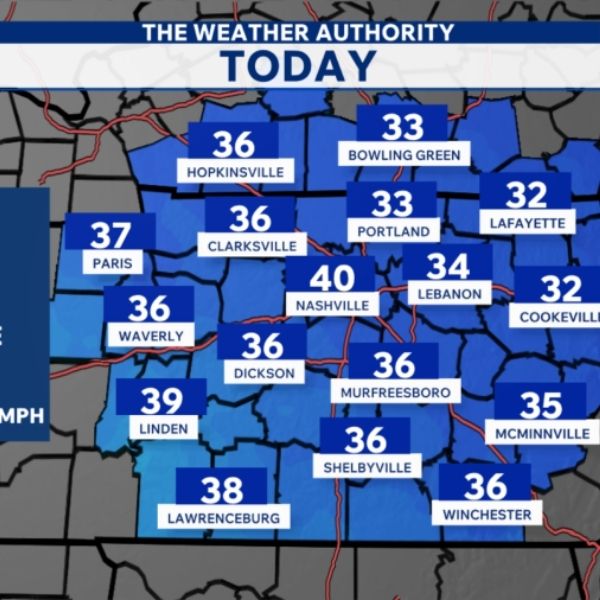
Sunshine on Tuesday, combined with a southwest wind, will push temperatures into the 30s to near 40 degrees for afternoon highs. Some eastern areas may remain cooler, staying in the upper 20s to lower 30s.
Tuesday evening into early Wednesday morning, temperatures are expected to dip below freezing before gradually rising as southerly winds increase. However, colder air aloft will remain in place, allowing a mix of snow and rain to develop Wednesday morning. Because this is expected to occur during the morning commute, some travel impacts are possible. By midday, temperatures should rise above freezing, leading to a transition to all rain.
Snow accumulation is expected to be light, with a coating possible and likely no more than a half-inch. Even so, the timing could make the situation tricky and lead to greater travel impacts.
Forecasters are also monitoring a stronger winter storm that is becoming more likely by the weekend.
Forecast data will continue to be closely monitored, with additional updates to follow.


Leave a Reply