Arctic air remains locked over Central and Eastern Kentucky as bitter cold conditions continue into Tuesday. A weak cold front moved through early Monday, reinforcing the chill despite plenty of sunshine during the day.
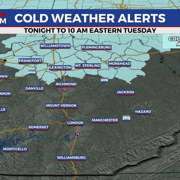
By early Tuesday morning, temperatures are expected to fall into the single digits, with wind chills dipping below zero in spots—especially across the Bluegrass Region. A Cold Weather Advisory remains in effect through 10 a.m. Tuesday, with wind chills as low as 5 degrees below zero.
Quiet but Frigid
Tuesday will stay dry and mostly sunny, but temperatures will struggle to warm, topping out in the upper 20s. Even with lighter winds, it will feel cold throughout the day.
A weak disturbance arrives Tuesday night into Wednesday, bringing a chance for light rain or snow showers. Impacts look minimal, as highs briefly rebound into the upper 30s to low 40s Wednesday before colder air returns by early Thursday.
Watching the Weekend
Attention then turns to the weekend, when another surge of Arctic air from Canada could combine with a southern weather system. This setup raises the potential for accumulating snow, particularly across southern and eastern Kentucky, though the exact track remains uncertain.
Forecast confidence will improve over the coming days, so residents are encouraged to stay alert for updates.
3-Day Forecast
-
Monday Night: Mostly clear and very cold. Wind chills below zero. Lows 5–10° central, low teens south.
-
Tuesday: Mostly sunny and cold. Highs in the upper 20s.
Tuesday Night: Mostly clear with slowly rising temps. Lows in the upper teens, rising into the 20s.


Leave a Reply