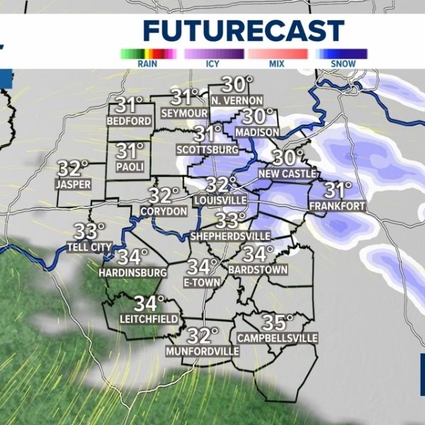
LOUISVILLE, Ky. — Bitter winter weather is expected along the Indiana–Kentucky border late this week, with overnight lows near 11 degrees and periodic chances for snow that could create slick travel conditions through early next week.
The National Weather Service says an arctic air mass will settle over the Ohio Valley from Saturday through Tuesday. Disturbances moving through the cold air may trigger scattered snow showers, while gusty northwest winds push wind chills into the single digits and occasionally below zero, especially overnight and early mornings.
Communities in southern Indiana and north-central Kentucky — including Clarksville, Jeffersonville, New Albany and Louisville — could see light snow accumulations and icy patches. Major routes such as Interstates 65, 64 and 71, along with untreated secondary roads, may become slick during snow showers or rapid temperature drops.
Officials urge residents to limit unnecessary travel, dress in warm layers, winterize vehicles and protect exposed pipes as the cold persists. Additional winter weather advisories are possible if snow coverage increases.


Leave a Reply