Unseasonably warm temperatures will continue, with windy conditions developing ahead of the next cold front expected toward the end of the week.
1-13-2026: Meteorologist Caitlyn Lorr shared details on increasing winds and the approaching cold front, which could bring snow and possible blizzard-like conditions to the area.
Warm temperatures will persist through today as winds strengthen ahead of the next low-pressure system and cold front. As the front approaches later this week, temperatures will begin to fall, with rain and snow possible between Thursday and Friday.
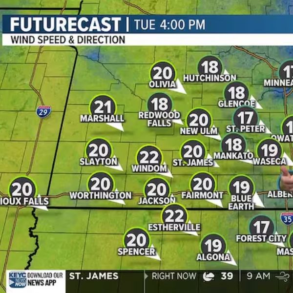
This afternoon is expected to remain relatively quiet despite increasing cloud cover and strengthening winds. Mostly sunny skies will start the morning before clouds gradually spread in during the afternoon and evening. Temperatures will reach the mid-40s by this afternoon, with winds sustained between 20 and 25 mph and gusts potentially reaching 35 mph. Winds will stay strong overnight as skies remain mostly cloudy and temperatures fall into the mid-teens by tomorrow morning. Drivers should use caution early tomorrow, as damp roads may refreeze overnight. Wind chill values will drop into the single digits tonight and could fall below zero by tomorrow morning.
Tomorrow will feel more seasonable as mostly cloudy skies begin to break, allowing sunshine to return for much of the day. Despite the sunshine, temperatures are expected to peak in the low 20s during the afternoon, with strong winds continuing. Sustained winds of 15 to 20 mph and gusts up to 30 mph will keep wind chills in the teens and single digits throughout the day. Winds will gradually ease late at night, with skies turning mostly cloudy and temperatures falling to around 11 degrees by Thursday morning.
The next system is expected to arrive on Thursday, bringing a chance for mixed precipitation before changing over to snow overnight. Temperatures are forecast to reach the low to mid-30s Thursday afternoon, supporting a rain and snow mix initially. Winds will remain strong, ranging from 15 to 25 mph with gusts up to 35 mph, which could reduce visibility due to blowing rain or snow. Temperatures are expected to peak later in the day, allowing mixed precipitation through the afternoon before colder air arrives overnight. By Friday morning, temperatures are projected to fall into the mid to upper 20s.
Snowfall totals are currently estimated to range between 1 and 4 inches across the area. This range is expected to become more refined as Thursday and Friday approach.
The cold front will move through on Friday, keeping skies cloudy with scattered snow showers throughout the day. Strong winds will persist, raising concerns for blizzard-like conditions as sustained winds reach 20 to 30 mph with gusts up to 40 mph. These conditions could lead to travel advisories, with snow continuing into Friday night. Temperatures will steadily fall through the day, starting in the upper 20s and low 30s during the morning and dropping into the teens and 20s by late afternoon. By Saturday morning, temperatures are expected to fall into the single digits as skies remain cloudy. Snow is forecast to taper off late Friday night, with a few lingering flurries possible.
Saturday is expected to be bitterly cold, with a stray flurry or two possible. Temperatures will remain in the single digits through the afternoon under mostly cloudy skies, with breezy conditions continuing. Winds of 15 to 25 mph and gusts up to 35 mph will drive wind chill values well below zero throughout the day. Saturday night will stay mostly cloudy and breezy, with temperatures dropping close to zero by Sunday morning.
Sunday will remain mostly cloudy with a chance of snow showers throughout the day. Afternoon temperatures will hover in the mid-teens as winds remain breezy, sustained between 15 and 20 mph with gusts up to 30 mph. Blowing snow and reduced visibility will continue to pose hazards. Snow is expected to end early Sunday night, leaving mostly cloudy skies and temperatures falling into the single digits by Monday morning.
Looking ahead to next week, conditions are expected to be quieter. Partly cloudy skies are forecast for Monday and Tuesday, followed by mostly cloudy conditions on Wednesday and Thursday. Temperatures will be more seasonable, ranging from the mid to upper teens to the low 20s. Winds will stay slightly breezy at times, averaging 10 to 15 mph with gusts up to 25 mph. Overnight lows are expected to drop into the single digits and low to mid-teens.


Leave a Reply