Temperatures remain unseasonably warm this week, approaching near-record highs, and mild conditions are expected to persist through the workweek.
However, attention is turning to a potential active weather system Thursday into Friday. Rain showers and thunderstorms are possible, with a conditional risk for severe storms Thursday night. Friday afternoon may see lingering severe weather, especially in Western Kentucky. Rainfall totals are expected to average between 0.5–1.25 inches, with some locally higher amounts, though widespread flooding is not anticipated.
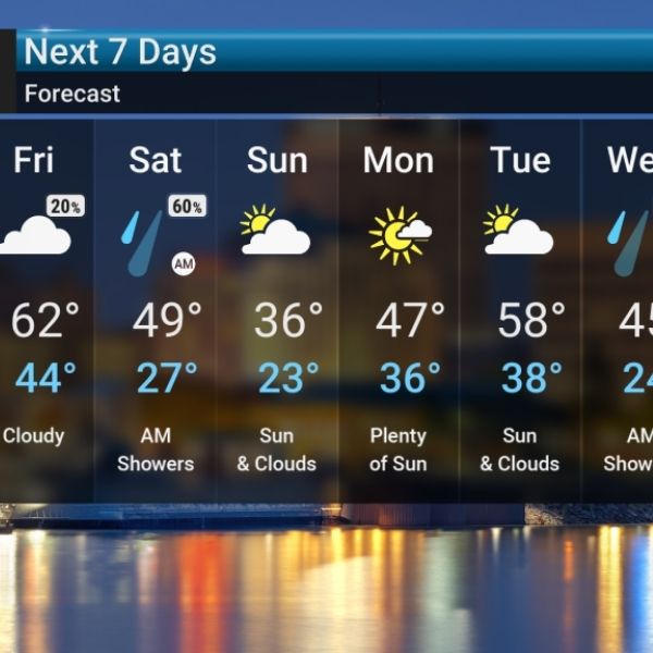
After this unsettled period, a sharp cooldown is expected. Colder, more seasonal January temperatures will return this weekend into early next week, with Sunday’s highs likely only in the 30s.


Leave a Reply