After gusty winds and a strong cold front sparked severe storms across the region Sunday night, the rest of the week is shaping up to be much quieter — and much colder.
The storms followed a prolonged stretch of above-average temperatures, bringing a sharp drop in readings and causing widespread disruption. Many residents experienced power outages, and some areas along the Kentucky-Indiana border even saw possible tornado activity. Meteorologist Justin Gibbs with the National Weather Service in Paducah said the event proved challenging to forecast.
Gibbs said crews will assess damage to determine whether straight-line winds or a brief spin-up tornado caused it.
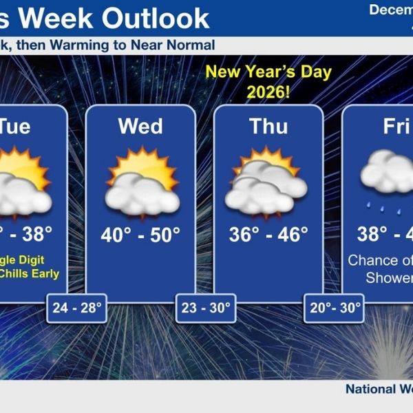
With the storms now behind us, Gibbs said cold temperatures will dominate the start of the week before leveling out closer to seasonal norms. He added that little precipitation is expected.
Looking ahead to the 8- to 14-day outlook, Gibbs said forecasts are trending slightly warmer, with near-normal precipitation. He also said he does not see any signs of severe weather on the horizon.
Weather remained especially active throughout 2025, and the National Weather Service will continue monitoring conditions and preparing the region for whatever the year ahead may bring.
This article has been carefully fact-checked by our editorial team to ensure accuracy and eliminate any misleading information. We are committed to maintaining the highest standards of integrity in our content.


Leave a Reply