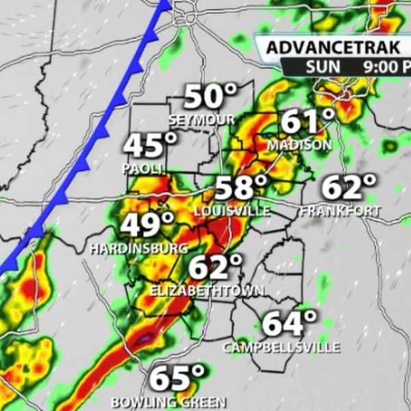
After enjoying unseasonably warm weather, a strong cold front is set to sweep through the region Sunday night, bringing a dramatic shift in conditions.
Sunday: Warm and Breezy
-
Highs could reach the low 70s, potentially breaking the previous record of 70° set in 2021.
-
Winds will pick up ahead of the front, with gusts of 40+ mph and isolated gusts exceeding 50 mph.
-
Any storms ahead of the front are expected to weaken but could briefly produce stronger gusts west of I-65.
Sunday Night into Monday: Temperature Plunge
-
Temperatures will drop sharply behind the front, falling nearly 50 degrees overnight.
-
Monday morning lows are expected in the low-to-mid 20s.
-
Wind chills will make it feel like single digits in some areas.
Main Impacts
-
Strong, potentially damaging wind gusts of 40–50+ mph.
-
Rapid temperature drop creating a stark contrast from Sunday’s warmth.
-
Breezy conditions continue Monday, even with some sunshine.
Residents are advised to dress warmly, secure outdoor items, and prepare for rapidly changing conditions. This is a classic example of a fast-moving winter cold front bringing both wind and cold air in a single overnight shift.
This article has been carefully fact-checked by our editorial team to ensure accuracy and eliminate any misleading information. We are committed to maintaining the highest standards of integrity in our content.


Leave a Reply