Kentucky is expected to see another round of winter weather on Friday, according to the National Weather Service.
A band of precipitation is forecast to move across the commonwealth ahead of a cold front. The National Weather Service said the system could bring rain showers, a wintry mix, or snow along its track.
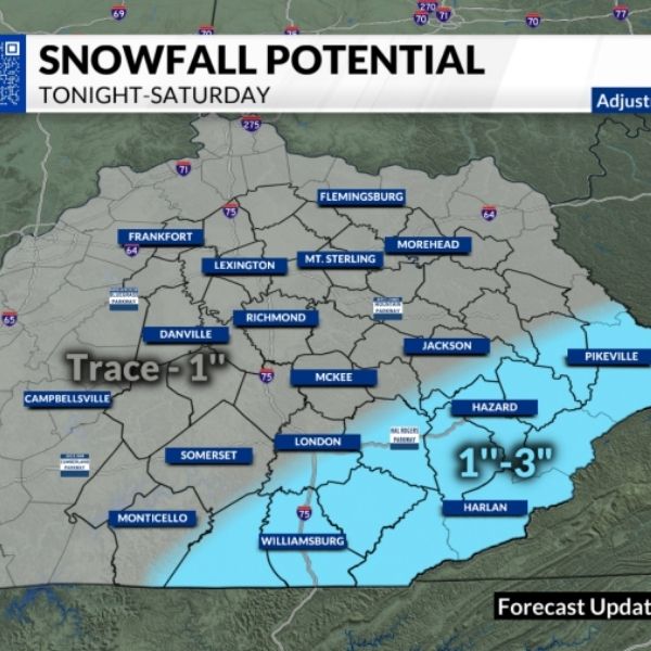
Western Kentucky is expected to stay mostly dry, with only a few rain showers possible, while Eastern Kentucky is likely to see mainly snow. The National Weather Service noted a sharp cutoff along the storm’s path between areas that will receive snow and those that remain mostly dry.
Lexington sits right along the boundary between snow and a wintry mix, according to the forecast. There is a 76% chance Lexington will see at least a dusting of snow and an 8% chance the city receives more than 1 inch.
The most likely window for snowfall is between 9 a.m. and 4 p.m., according to the National Weather Service. If Western Kentucky does receive snow, it is not expected until Friday night.
A winter weather advisory has been issued for Lexington and other parts of Northern and Central Kentucky from 7 a.m. to 5 p.m. Friday. The advisory calls for snow accumulations of up to 1 inch in most areas, which could create slippery and hazardous road conditions during the morning and evening commutes.
“It should be probably a dusting, one inch or less, but this can impact our roadways and folks need to be aware,” Gov. Andy Beshear said during his weekly news briefing.
Once the system moves out of the region Friday, there are no additional snow chances in the National Weather Service’s seven-day forecast for Lexington. The next opportunity for precipitation comes Tuesday night, with a 30% chance of rain.
Temperatures are expected to remain very cold at the start of the weekend before gradually warming through the middle of next week. Forecasts show highs in the mid-20s on Saturday, climbing into the 50s from Monday through Wednesday.
The warmer weather is expected to significantly reduce Lexington’s lingering snow and ice pack, which has persisted for nearly two weeks. As of Wednesday, the snowpack stood at 2 inches after about a quarter-inch of new snow fell Tuesday, according to the National Weather Service.
Lexington also recorded a trace of snow on Monday. The National Weather Service defines a trace as snowfall that never exceeds 0.1 inches because it melts as it reaches the ground.
In January, Lexington received 4.9 inches of snow, slightly above the normal total of 4.7 inches, according to the National Weather Service.


Leave a Reply