No tornado warning was issued for one of the storms in Kentucky on Tuesday.
LOUISVILLE, Ky. — The National Weather Service has confirmed that at least two additional tornadoes touched down in Kentucky during recent severe weather, including one that developed without a warning.
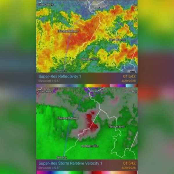
Although most storms Tuesday night did not become severe, the National Weather Service in Louisville found evidence that an EF-0 tornado briefly touched down in Hardin and LaRue counties near Roanoke.
Officials said the short-lived tornado produced estimated wind speeds of 80 mph.
Radar imagery showed a brief collision of winds that created a small couplet on velocity radar.
No tornado warning was issued for the storm, likely because the tornado formed and dissipated quickly.
In an update Wednesday afternoon, NWS Louisville said survey crews also confirmed a second tornado in Ohio County from Monday night’s storms.
Officials said that tornado touched down near southwest Heflin and received a preliminary EF-0 rating, with estimated winds between 85 and 90 mph.
Another area of Ohio County was also hit by an EF-1 tornado, with wind speeds reaching up to 100 mph.
So far, officials have confirmed five tornadoes across Kentucky and southern Indiana since the severe weather began Monday. Several counties also experienced straight-line wind damage.


Leave a Reply