(NEXSTAR) – Think your neighborhood is safe? A new interactive map from the U.S. Census Bureau may offer a different perspective on how secure your area really is.
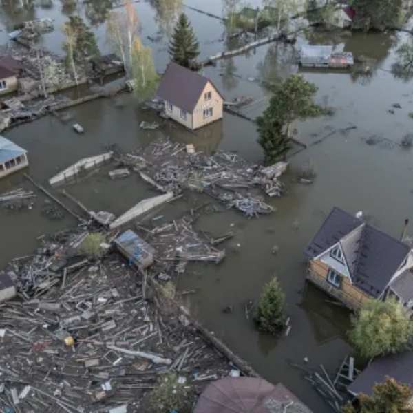
The map doesn’t track crime or traffic incidents. Instead, it highlights the risk level of natural disasters across every census tract, including threats like earthquakes, fires, floods and severe storms.
More importantly, it measures how much of the population is considered “socially vulnerable” during a disaster. This includes factors such as high poverty rates, crowded housing, a large elderly population, limited access to transportation and communication barriers — all of which can make it harder for people to reach safety.
For example, in Los Angeles, several neighborhoods fall into the highest-risk category, where more than 31% of residents face multiple vulnerability factors. In many of those areas, earthquakes pose the biggest threat, though wildfire risk is also present.
Looking at the map nationwide, Utah stands out as one of the least vulnerable states, with only a small percentage of its population considered at risk.
Users can zoom in to explore specific counties or neighborhoods, revealing both the percentage of vulnerable residents and the most likely disaster threats. Depending on location, risks may include anything from winter storms to hurricanes.
For those concerned about the findings, preparedness remains key. The Federal Emergency Management Agency recommends creating a household emergency plan that includes receiving alerts, identifying shelter options, mapping evacuation routes, establishing communication plans and assembling an emergency kit.
While each household’s needs may vary, basic supplies typically include water, food, a flashlight and a first aid kit.


Leave a Reply