UNITED STATES — A potentially dangerous severe weather setup is taking shape across the central United States from Thursday, April 3 through Saturday, April 4, 2026. Forecasters are closely watching a deepening upper-level trough expected to evolve into a closed low — a powerful configuration that can support widespread and organized severe storms across the Plains, Ohio Valley, and Tennessee Valley.
All data referenced is based on the ECMWF model initialized March 29, 2026, at 06z.
What’s Happening in the Upper Atmosphere
This setup centers on a deep upper-level trough dipping into the central U.S., pulling cold air southward while drawing warm, moist air north from the Gulf of Mexico. That clash of air masses creates an environment favorable for severe thunderstorms.
As the trough strengthens into a closed low, the system becomes more organized and longer-lasting, increasing the potential for widespread and sustained severe weather.
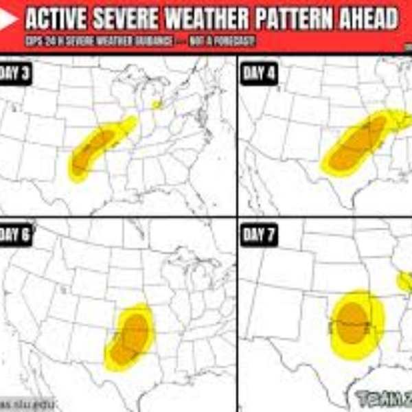
Thursday, April 3 — Trough Moves In
By Thursday evening, a strong upper-level trough is expected to dig into the central Plains. The jet stream will intensify over Kansas, Oklahoma, and Missouri, with energy extending toward the Ohio and Tennessee Valleys.
This setup places strong upper-level winds over areas rich in Gulf moisture — a classic combination for severe storm development.
Primary threat areas include Kansas, Oklahoma, Missouri, and Arkansas, with storms likely spreading into Illinois, Kentucky, and Tennessee through the evening.
Saturday, April 4 — Closed Low Strengthens
By Saturday, the system is expected to intensify into a closed low over the central Plains — the more concerning phase of the event.
As the system shifts east, the strongest dynamics will move into the Ohio Valley and Tennessee Valley, expanding the threat into more densely populated regions.
States at higher risk Saturday include Tennessee, Kentucky, Indiana, Ohio, Mississippi, and Alabama, with potential impacts extending into Georgia and the Carolinas.
Day-by-Day Threat Breakdown
Thursday, April 3 — Strong trough develops. Primary risk across Kansas, Oklahoma, Missouri, and Arkansas. Secondary risk into Illinois, Kentucky, and Tennessee. Main threats include damaging winds and large hail. Timing: afternoon through evening.
Friday into early Saturday — Transition period as the system strengthens. Widespread showers and storms possible from the Plains to the Ohio Valley.
Saturday, April 4 — Closed low fully develops. Primary threat shifts east into Tennessee, Kentucky, Indiana, Ohio, Mississippi, and Alabama. Threats include organized severe storms, heavy rain, and a possible tornado risk. Timing: throughout the day and evening.
Upper-Level Wind Signal by Region (April 3)
Kansas and Oklahoma — strongest jet stream energy, highest risk
Missouri and Arkansas — strong dynamics, significant threat
Illinois and Kentucky — moderate to strong dynamics, secondary risk
Tennessee and Ohio Valley — increasing storm potential through evening
Mississippi and Alabama — limited Thursday threat, increasing into Friday
Forecast Confidence
Forecasters have high confidence that a strong upper-level trough will arrive over the central Plains by Thursday, April 3, with consistent model agreement.
Confidence is also high that the system will evolve into a closed low by Saturday, April 4.
There is medium confidence in the exact coverage and intensity of severe weather, as surface conditions and moisture placement will determine storm strength.
Confidence remains lower regarding tornado potential, as key ingredients like wind shear and helicity will become clearer closer to the event.
What This Means for Residents
This type of setup signals a prolonged and organized severe weather event rather than a quick-moving storm.
Residents in Kansas, Oklahoma, Missouri, and Arkansas should closely monitor conditions for Thursday.
Those in Tennessee, Kentucky, Indiana, Ohio, Mississippi, and Alabama should prepare for Saturday’s higher risk.
Preparation should begin early in the week rather than waiting for watches or warnings.
Identify a safe shelter location in advance — ideally an interior room on the lowest floor, away from windows.
Keep a battery-powered or hand-crank weather radio ready, as power outages are possible during severe storms.
The Bottom Line
A two-day severe weather threat is expected across the central and eastern United States, beginning Thursday, April 3, and intensifying by Saturday, April 4. Initial storms will impact the Plains before shifting east into the Ohio and Tennessee Valleys. With a strong upper-level system in place, this setup could bring widespread severe weather, making early preparation essential.
Stay informed and monitor forecasts as the system develops — early awareness can make a critical difference.


Leave a Reply