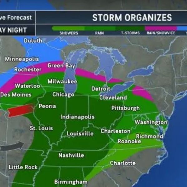
A potent storm system is expected to bring severe thunderstorms to the Ohio Valley on Thursday, with all modes of severe weather possible.
For many communities, this could be the first thunderstorm of the year — and the first setup with a tornado risk since autumn.
🌩 What’s Expected Thursday
The severe threat will stretch along and east of the Mississippi River, impacting parts of:
-
Iowa
-
Missouri
-
Illinois
-
Indiana
-
Ohio
-
Kentucky
-
West Virginia
🌪 Possible hazards include:
-
Damaging wind gusts
-
Large hail
-
A few tornadoes
-
Torrential downpours that could trigger flash flooding
The strongest storms are most likely near:
-
Louisville
-
Indianapolis
⛈ Thursday Night Expansion
Thunderstorms — including lightning and heavy rain — may extend farther northeast into:
-
Michigan (southern areas)
-
Northeastern Ohio
-
Western Pennsylvania
While not all of these areas are expected to see severe weather, thunderstorms are likely.
🌦 Friday Outlook
On Friday, thunderstorms may develop across portions of the Southeast and Mid-Atlantic. However, most are expected to remain below severe limits, despite sufficient warmth and moisture.
⚠️ What to Keep in Mind
-
This is not necessarily a widespread outbreak scenario.
-
However, all severe modes are possible, meaning conditions could become dangerous quickly in localized areas.
Make sure you have multiple ways to receive warnings, especially if storms develop after dark.
This article has been carefully fact-checked by our editorial team to ensure accuracy and eliminate any misleading information. We are committed to maintaining the highest standards of integrity in our content.


Leave a Reply