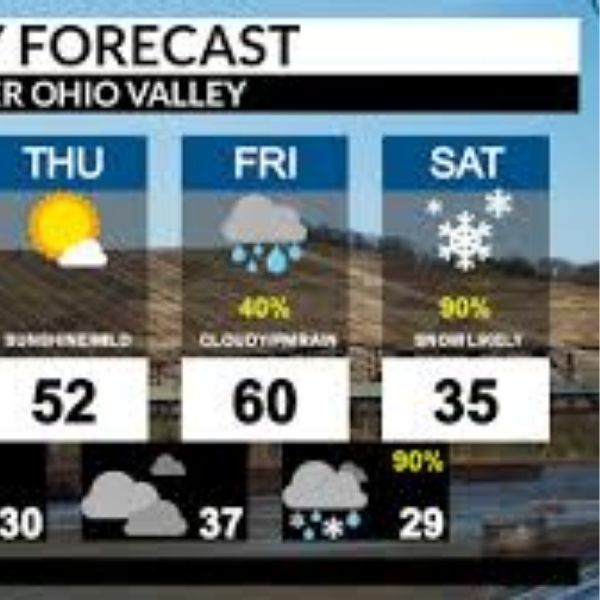
Columbus, OH – A wetter pattern is setting up across the Ohio Valley this week, with several rain chances expected through next Friday, according to the National Weather Service Ohio River Forecast Center.
The NWS reports that a series of disturbances will move through the Ohio River and Lake Erie drainage basins over the next seven days, delivering multiple rounds of rainfall. Forecasters say the highest totals—potentially topping 3 inches—are likely in the western part of the basin, which includes portions of Ohio, Indiana, Kentucky, and Illinois.
The latest 7-day precipitation outlook, released Friday morning, indicates widespread wet conditions returning after a recent period of near- or below-normal streamflow values. Hydrologists noted that while confidence remains low for now, the expected rainfall could bring a 10% chance of river rises across several Ohio Valley waterways as the pattern develops.
Forecasters emphasize that any river impacts will depend on how each storm system tracks next week. Even a slight shift could change which communities receive heavier or lighter rainfall. Additional model updates are expected over the weekend.
Residents across the Ohio Valley should keep a close eye on forecasts, particularly those who live near rivers, creeks, or flood-prone rural areas. More information on possible river-level changes is expected early next week as confidence improves.


Leave a Reply