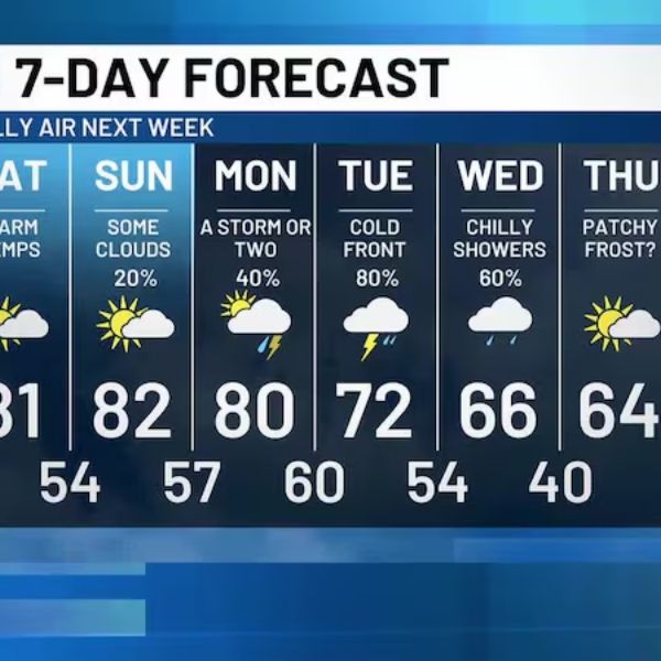
LEXINGTON, Ky. (WKYT) — Scattered showers and storms are increasing across Kentucky today and are expected to intensify Tuesday as a fall cold front moves through, potentially causing local high-water issues.
Forecast Overview:
-
Showers and storms will ramp up today, especially in central and western Kentucky.
-
Locally heavy rain may occur, though it won’t be widespread.
-
Rounds of showers and storms will continue tonight into Tuesday night, with widespread heavy rain.
-
Storms could drop torrential rainfall, putting down a few inches quickly.
-
Overall, 1–3 inches of rain are likely through Wednesday morning, with some areas receiving slightly less and a few spots exceeding that amount.
-
Local high-water issues are possible at any point through Wednesday morning.
-
Storms may bring loud thunder and gusty winds, but severe weather is not expected.
-
Showers will linger into Wednesday, tapering off from northwest to southeast.
After the Storms:
-
Cool fall winds will follow the cold front.
-
Highs will generally be in the 60s starting Wednesday, with Thursday morning lows dipping into the upper 30s in some areas.
-
Pleasant fall temperatures are expected through the end of the week and into the weekend.


Leave a Reply