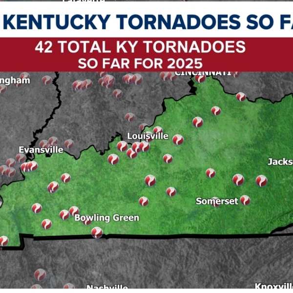
KENTUCKY — Strong to severe storms are set to move into Kentucky on Monday, bringing a risk of tornadoes as part of a widespread severe weather outbreak, according to the National Weather Service Storm Prediction Center.
Forecasters say Kentucky lies within a broad severe weather zone stretching from the mid-Mississippi Valley into the lower Ohio Valley, with conditions supporting tornadoes, damaging winds, and large hail.
SPC Day 1 Tornado Outlook
While the highest risk for strong, long-track tornadoes is expected farther west in Missouri and Illinois, parts of Kentucky still face a tornado threat, especially during the afternoon and evening hours.
The Storm Prediction Center notes that western Kentucky could see a higher tornado risk than areas farther east, as storms move in from Missouri and Arkansas.
Storms are expected to develop and strengthen in an environment with warm, moist air and strong wind shear—conditions that can produce rotating thunderstorms capable of generating tornadoes.
Along with the tornado risk, forecasters warn of large hail and damaging wind gusts.
They also say storms may organize into clusters in the evening, with the chance of embedded tornadoes continuing overnight.
Residents are urged to stay alert and have multiple ways to receive warnings as conditions change.


Leave a Reply