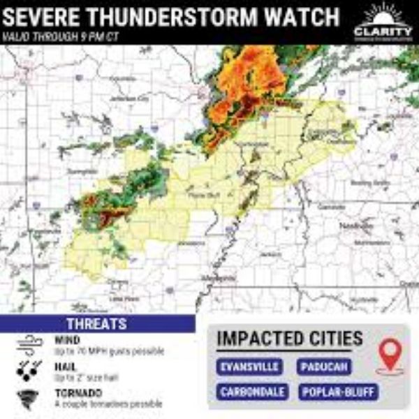
PADUCAH, Ky. — Strong thunderstorms could bring damaging winds, power outages and travel disruptions across western Kentucky before 9 p.m. Wednesday as storms move toward the Ohio River.
According to the National Weather Service Storm Prediction Center, Severe Thunderstorm Watch 11 remains in effect until 9 p.m. CST Wednesday for Ballard, Carlisle, Crittenden, Daviess, Fulton, Henderson, Hickman, Livingston, McCracken, Union and Webster counties.
Storms may intensify later in the afternoon and evening, producing wind gusts up to 60 mph and hail large enough to dent vehicles. Travel along Interstate 69 near Henderson and the Wendell Ford Expressway in Owensboro could become hazardous during periods of heavy rain.
In Paducah and surrounding McCracken County, brief torrential downpours could reduce visibility to less than a mile and cause water to collect on low-lying roads.
Residents are encouraged to secure outdoor items, charge electronic devices and prepare for possible isolated power outages. Anyone with evening plans should monitor weather alerts and move indoors quickly if warnings are issued.
The watch remains in effect through 9 p.m., and additional severe thunderstorm warnings could be issued with little notice if storms continue to strengthen.


Leave a Reply