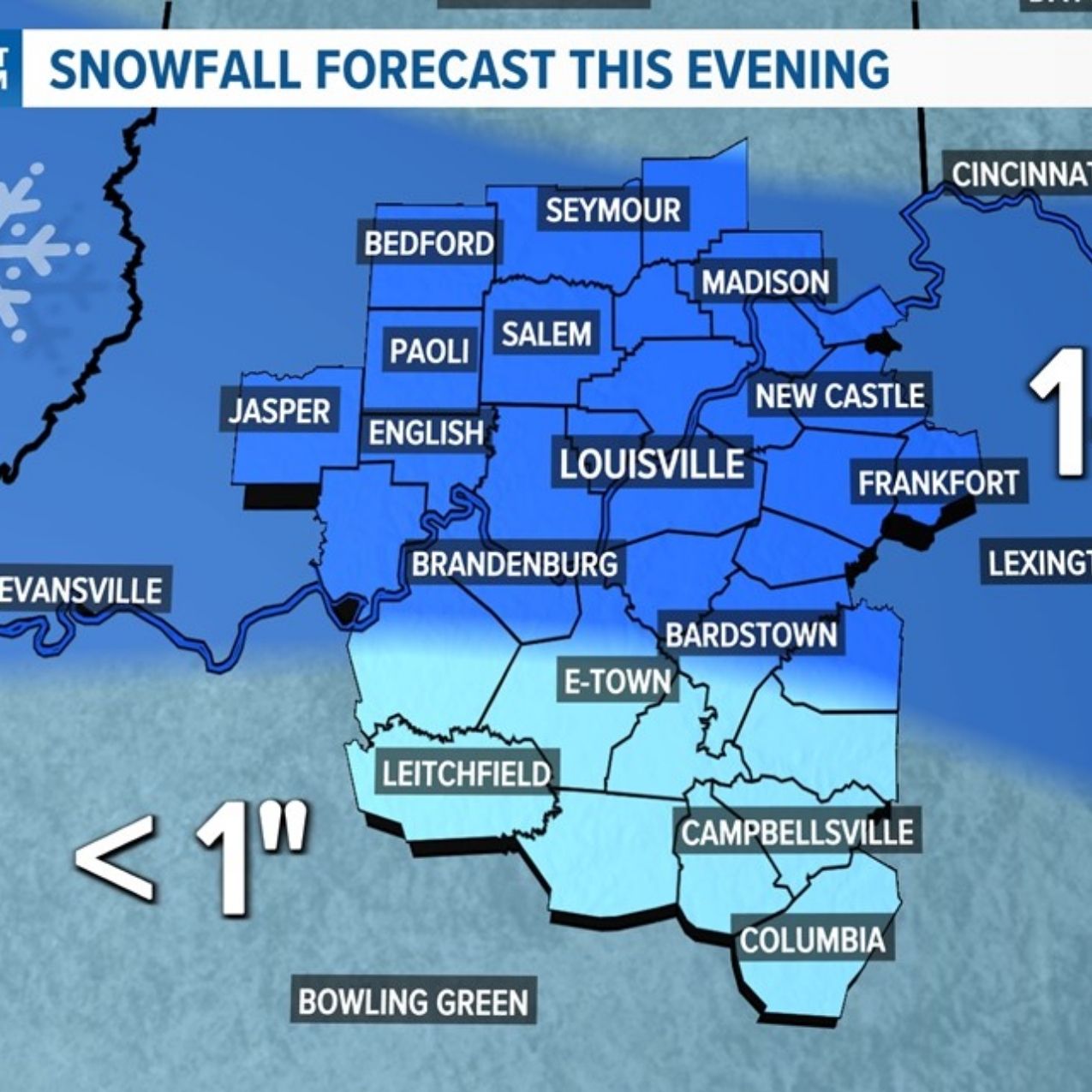
Louisville, Kentucky-Indiana Border – Snow may begin coating bridges and untreated roads along I-64 and I-65 by 6 a.m. Sunday. Forecasters estimate a 30 to 50 percent chance that at least 2 inches will accumulate across southern Indiana and northern Kentucky before 6 a.m. Monday.
According to the National Weather Service, a developing winter system is expected to move across the Ohio Valley late Saturday night through Sunday night. This track places the Louisville metro, Evansville, and Bloomington in a zone favorable for accumulating snowfall. Current projections show the highest probabilities for 2 inches or more along and north of the Ohio River. However, slight shifts in the storm’s path could bring heavier totals farther into central Kentucky or push them north toward Indianapolis.
If steady snowfall develops during the Sunday morning travel period, visibility may fall below one mile in heavier bands. Elevated roadways, including the Kennedy and Sherman Minton bridges over the Ohio River and interchanges along I-265, could become slick first as surface temperatures linger near freezing.
The Indiana Department of Transportation and the Kentucky Transportation Cabinet are monitoring pavement temperatures and positioning equipment in advance of potential impacts. Even small changes in snowfall rates could quickly alter road conditions during peak travel times.
Officials advise residents to limit non-essential travel during heavier bursts of snow, inspect tire tread, and allow additional stopping distance. Winter weather advisories could be issued by Saturday as forecasters gain more confidence in snowfall placement and totals through early Monday morning.


Leave a Reply