Louisville, Kentucky — Mild and mostly dry conditions will continue across central Kentucky and southern Indiana through tonight, but fog and light rain could affect travel late tonight and into Tuesday.
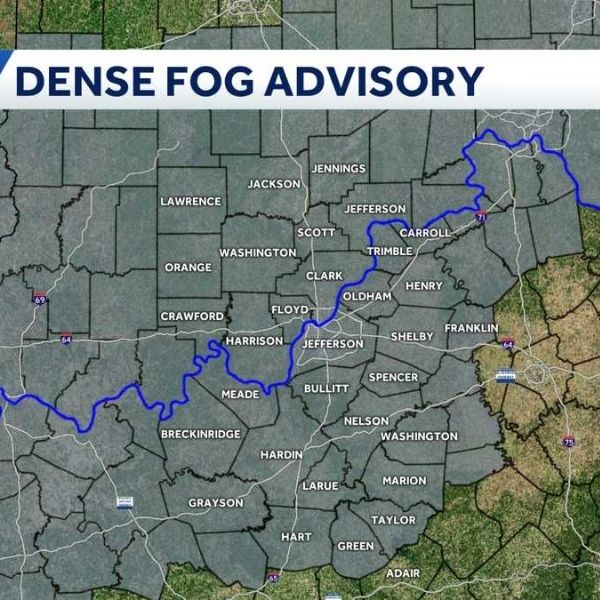
The National Weather Service in Louisville said fog could develop late tonight through Tuesday morning, with the highest risk around daybreak. Low-lying areas and river valleys are most likely to see reduced visibility, which could impact the morning commute.
Overnight temperatures are expected to stay relatively mild, ranging from the upper 20s to low 30s across southern Indiana and northern Kentucky, and from the mid-30s to near 40 degrees in southern Kentucky. Combined with lingering moisture, these conditions may allow patchy fog to form before sunrise.
Temperatures will continue to warm on Tuesday, reaching the upper 50s to low 60s across southern Indiana and northern Kentucky, with mid-60s possible in southern Kentucky. While most of the day is expected to remain dry, chances for light rain increase later Tuesday afternoon and into Tuesday night, especially during the evening.
Major roadways, including Interstates 64, 65, 71, and 265, along with the Bluegrass Parkway, could see reduced visibility from fog early Tuesday, followed by wet road conditions as rain moves in. Although no winter weather is expected, slick spots could develop where fog and drizzle occur.
The National Weather Service said rainfall amounts should remain light, with no flooding concerns at this time. Conditions are expected to improve by Wednesday, with cooler temperatures and partly sunny skies.
Commuters, school transportation drivers, and early-morning travelers are advised to allow extra time Tuesday morning and use low-beam headlights in areas prone to fog.
Forecast confidence remains moderate, as fog coverage will depend on overnight cloud conditions. Residents are encouraged to monitor updated forecasts and prepare for changing visibility through Tuesday morning.


Leave a Reply