LEXINGTON, Ky. (WKYT) – Old Man Winter continues to keep a tight grip on Kentucky and nearby areas, with cold conditions expected to linger for a few more days. A more noticeable thaw looks ready to move in once next week arrives, at least for a short time.
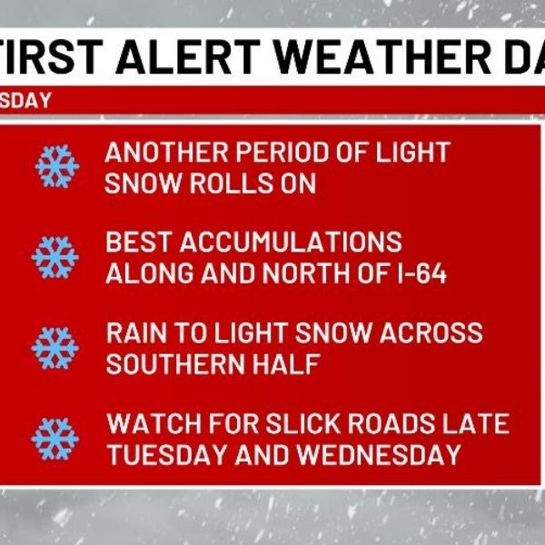
Light snow is falling this morning, with the heaviest concentration across southern and southeastern parts of the state as a wave of low pressure moves into the southern Appalachian Mountains. Some light freezing drizzle is also possible. Low-level moisture remains in place across much of Kentucky, allowing for additional pockets of light snow through tonight.
A weak system could bring another round of light snow showers by Thursday night, with a better chance for a broader area of light snow and snow showers across central and eastern Kentucky. Future radar from the NAM model highlights this potential from Thursday night through Friday night.
Behind this system, temperatures turn frigid once again. That cold won’t last long, however, as a quick warmup is expected by early next week. Kentucky should finally see a period of thawing before the overall pattern begins to shift back toward deeper troughs pushing into the eastern United States.


Leave a Reply