KENTUCKY — Forecast models continue to indicate the potential for winter weather across Kentucky this weekend, as of Monday afternoon.
Both the Euro and GFS models show a winter storm moving in from the southwest and tracking toward the East Coast, with impacts possible in Kentucky on Saturday, Jan. 25, and Sunday, Jan. 26.
It is important to remember these are model projections, and conditions can and will change.
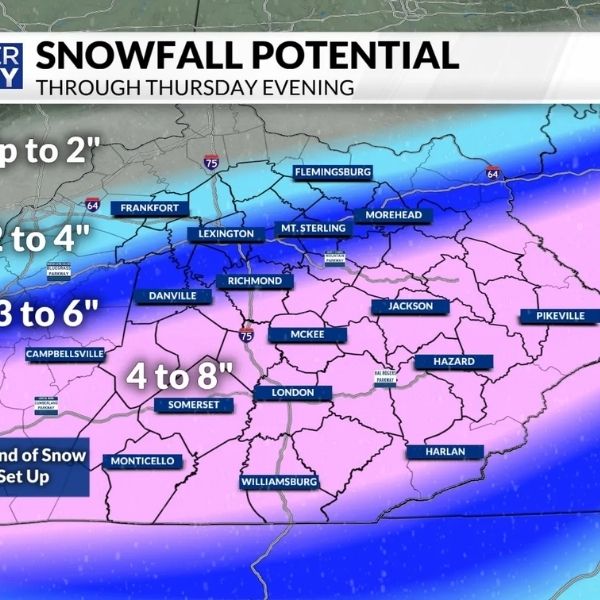
Regarding snowfall amounts, the GFS model shows a more southern track, which would result in less snow for much of Kentucky. Under this scenario, a couple of inches of snow could fall across parts of southeastern Kentucky.
The Euro model, however, suggests a more northern track, which would bring higher snowfall totals across the state. Predicted amounts from the Euro model are shown below.
The National Weather Service currently indicates at least a reasonable chance for minor winter weather impacts across Kentucky this weekend.


Leave a Reply