ALERT DAYS
TONIGHT (1/16/26) IMPACT: Slushy and slick travel
WEATHER HEADLINES
NEXT 12: Winter Weather Advisory east of I-65 until 10 a.m., with a few snow showers possible
SHORT TERM: Additional snow showers Saturday and Sunday with light accumulation possible
LONG TERM: More wintry weather expected by the middle of next week and again next weekend
FORECAST
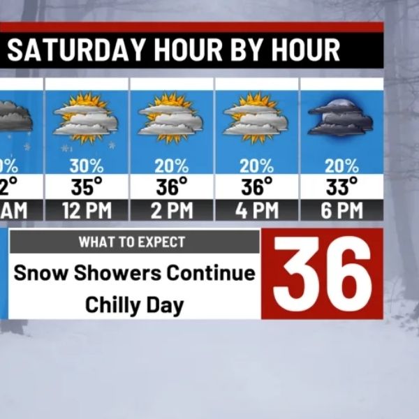
Here’s WAVE News meteorologist Ryan Hoke with your forecast.
LOUISVILLE, Ky. (WAVE) — Wet snow will taper off for most areas by midnight, followed by a few snow showers through early Saturday morning. Temperatures will fall below freezing by Saturday morning, creating the potential for slick spots.
Saturday will remain cold, with afternoon highs only reaching the 30s. More snow showers are expected around dinnertime, which could leave a dusting to a light coating of snow across Kentucky counties if temperatures remain cold enough.
Snow showers during the early evening may leave behind slick road conditions Saturday night as they move out. Drivers are urged to use caution. Temperatures will drop sharply overnight, falling into the teens by Sunday morning.
While a brief round of flurries is possible Sunday evening, much of the day should stay dry with some sunshine. Highs will struggle to reach the upper 20s during the afternoon.
Looking ahead to next week, the risk for additional wintry weather increases. Current forecasts show potential impacts late Wednesday night into early Thursday, with another chance next weekend. This is a period to monitor closely.


Leave a Reply