Watch for icy spots Thursday morning as temperatures drop into the upper teens, with wind chills in the single digits.
Snow showers will continue, with narrow bands of heavier snow moving through at times. While there will be lulls, flurries and snow showers are expected throughout much of the day, potentially leaving a light coating to an inch. Conditions should dry out tonight, but it will remain very cold.
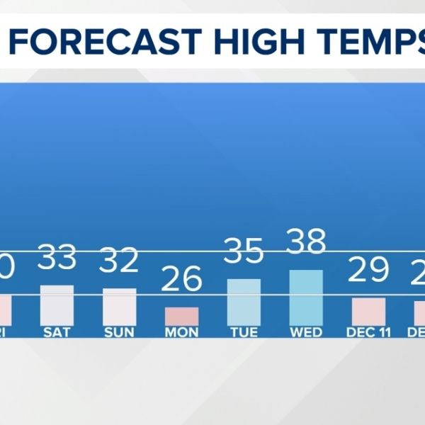
Friday’s temperatures will rebound closer to freezing as the next disturbance moves in, bringing another round of snow showers Friday night into early Saturday. Like Thursday, significant accumulation is not expected, but slick travel is possible, especially during the morning hours.
An Arctic blast is expected early next week, with temperatures plunging into the single digits by Monday night and wind chills possibly well below zero. Winter is here to stay.


Leave a Reply