NASHVILLE, Tenn. (WKRN) — The next storm system is expected to bring a chance of snowfall to parts of Middle Tennessee and Southern Kentucky.
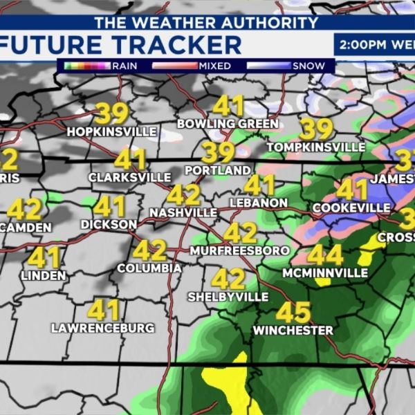
An area of low pressure along with an attached cold front will move into the News 2 viewing area Wednesday morning. With temperatures in the 40s and 50s, rain is expected during the morning hours.
As the cold front passes around midday, rain will transition to snow during the afternoon across the Cumberland Plateau.
Most areas are not expected to see any snow, but locations that do could receive a light coating to up to an inch of accumulation.
All precipitation is expected to clear the region by Thursday morning. The main impact on Thursday will be bitterly cold temperatures and strong northerly winds, with wind chills dropping into the single digits across much of the area.


Leave a Reply