LEXINGTON, Ky. (FOX 56) — A double round of winter weather is expected, unfolding within about a 24-hour period.
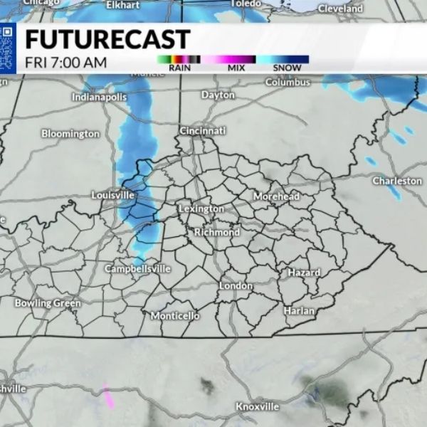
Friday morning will bring the first wave, as a narrow band of snow moves across the northern half of the state. Light accumulation is possible during the morning commute.
A Winter Weather Advisory has been issued due to expected light accumulations and will remain in effect until 10 a.m. Friday.
The second round of winter weather is expected to have a greater impact. Friday afternoon, rain will push north into Kentucky as a cold front moves through the region.
Precipitation is expected to begin as rain before colder air gradually changes it to snow overnight. During the transition, a mix of rain, sleet, and snow is likely.
Once the changeover to snow is complete, snowfall is expected to continue into Saturday morning, with scattered snow showers lingering into the afternoon.
This system presents some uncertainty, as it involves a battle between warm and cold air.
A boom-or-bust scenario remains possible, with a general coating of about 1 inch expected. The key question is how quickly rain changes to snow.
If the transition happens earlier, as some forecast models indicate, a “boom” scenario could bring a swath of 1 to 3 inches of snow across central Kentucky.
Forecast adjustments and fine-tuning are expected Friday morning as the system approaches.
After this system moves out, Arctic air will settle in early next week. Overnight lows are expected to drop into the low teens, with daytime highs struggling to reach the upper 20s beginning Sunday.
Bitter wind chills are expected to return by Sunday morning, with sub-zero wind chills possible. This pattern is expected to repeat into early next week


Leave a Reply